Middleburg in Carroll County, Maryland — The American Northeast (Mid-Atlantic)
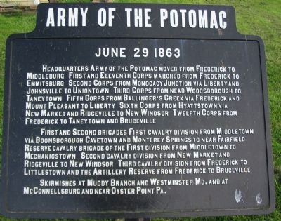
Army of the Potomac
June 29 1863
Headquarters Army of the Potomac moved from Frederick to Middleburg. First and Eleventh Corps marched from Frederick to Emmitsburg. Second Corps from Monocacy Junction via Liberty and Johnsville to Uniontown. Third Corps from near Woodsborough to Taneytown. Fifth Corps from Ballinger's Creek via Frederick and Mount Pleasant to Liberty. Sixth Corps from Hyattstown via New Market and Ridgeville to New Windsor. Twelfth Corps from Frederick to Taneytown and Bruceville.
First and Second Brigades First Cavalry Division from Middletown via Boonsvorough, Cavetown and Monterey Springs to near Fairfield. Reserve Cavalry Brigade of the First Division from Middletown to Mechanicstown. Second Cavalry Division from New Market and Ridgeville to New Windsor. Third Cavalry Division from Frederick to Littlestown and the Artillery Reserve from Frederick to Bruceville.
Skirmishes at Muddy Branch and Westminster Md. and at McConnellsburg and near Oyster Point Pa.
Erected by Gettysburg National Military Park Commission.
Topics. This historical marker is listed in this topic list: War, US Civil.
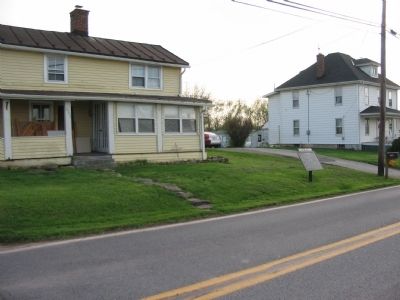
Location. 39° 35.666′ N, 77° 12.968′ W. Marker is in Middleburg, Maryland, in Carroll County. Marker is on Middleburg Road (State Highway 77), on the right when traveling east. Touch for map. Marker is at or near this postal address: 6105 Middleburg Road, Keymar MD 21757, United States of America. Touch for directions.
Other nearby markers. At least 8 other markers are within 3 miles of this marker, measured as the crow flies. Middleburg (approx. 0.4 miles away); “Terra Rubra” (approx. 1.7 miles away); The First Reaping Machine (approx. 2.4 miles away); Elmer A. Wolfe High School (approx. 2.4 miles away); Union Bridge (approx. 2.7 miles away); Western Maryland Railway Honor Roll (approx. 2.7 miles away); World's First Reaping Machine (approx. 2.7 miles away); Birthplace of Francis Scott Key (approx. 2.8 miles away).
Also see . . . An Enduring Controversy: The Pipe Creek Circular and the Battle of Gettysburg. Emerging Civil War website entry (Submitted on April 12, 2022, by Larry Gertner of New York, New York.)
Photographed By Craig Swain, April 4, 2010
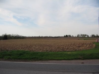
5. Left Flank of Pipe Creek Line
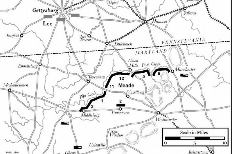
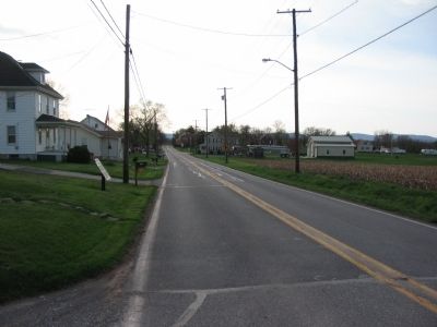
In the closing days of June 1863, General Meade ordered the concentration of the Army of the Potomac along Pipe Creek in order to block any Confederate move toward Washington, D.C. or Baltimore, Maryland. Under Meade's plan, the First Corps, under General Reynolds, would occupy the far left end of the line. Their tentative position was just north of Middleburg, on the high ground overlooking Big Pipe Creek. That ground is in the distance of this view from the road near the marker.
Credits. This page was last revised on April 12, 2022. It was originally submitted on April 4, 2010, by Craig Swain of Leesburg, Virginia. This page has been viewed 1,473 times since then and 37 times this year. Photos: 1, 2. submitted on April 4, 2010, by Craig Swain of Leesburg, Virginia. 3. submitted on April 12, 2022, by Larry Gertner of New York, New York. 4, 5. submitted on April 4, 2010, by Craig Swain of Leesburg, Virginia.
