Greenville in Greenville County, South Carolina — The American South (South Atlantic)
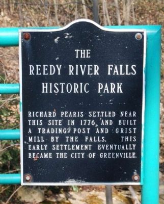
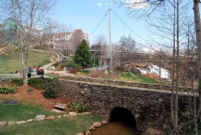
Reedy River Falls Historic Park
Erected 1996 by City of Greenville.
Topics. This historical marker is listed in these topic lists: Industry & Commerce • Settlements & Settlers • Waterways & Vessels. A significant historical year for this entry is 1776.
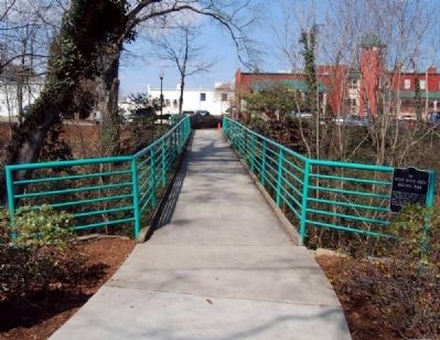
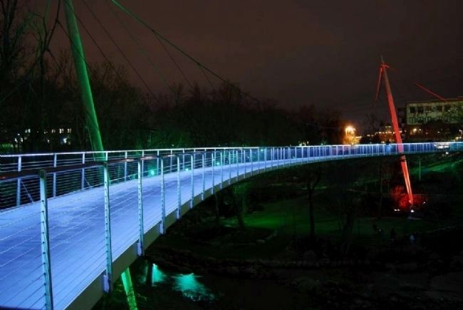
Location. Marker has been reported permanently removed. It was located near 34° 50.6′ N, 82° 24.233′ W. Marker was in Greenville, South Carolina, in Greenville County. Marker could be reached from University Street. Marker is located near the west end of the walking bridge just off University Street behind the Westend Market. Touch for map. Marker was in this post office area: Greenville SC 29601, United States of America.
We have been informed that this sign or monument is no longer there and will not be replaced. This page is an archival view of what was.
Other nearby markers. At least 8 other markers are within walking distance of this location. Alliance Cotton Warehouse (within shouting distance of this marker); Mills & McBayer Cotton Warehouse (about 300 feet away, measured in a direct line); Greenville Arboretum (about 400 feet away); Wilson Cooke (about 500 feet away); The Touchstone House "Falls Cottage" (about 600 feet away); The Touchstone House (about 700 feet away); Chicora College (about 700 feet away); Restoration and Development (about 700 feet away). Touch for a list and map of all markers in Greenville.
Also see . . .
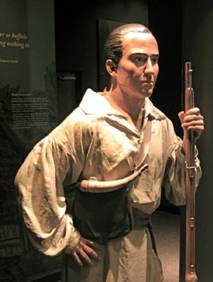
1. Richard Pearis. Richard Pearis (1725 – 1794) was an Indian trader, a pioneer settler of Upstate South Carolina, and a Loyalist officer during the American Revolution. (Submitted on April 21, 2010, by Brian Scott of Anderson, South Carolina.)
2. Falls Park on the Reedy. Falls Park on the Reedy is a 32-acre (130,000 m2) park adjacent to downtown Greenville, South Carolina in the historic West End district. (Submitted on April 21, 2010, by Brian Scott of Anderson, South Carolina.)
3. Reedy River Falls Historic Park and Greenway. The Reedy River Falls are not only the geographical but also the historical center of Greenville. (Submitted on April 21, 2010, by Brian Scott of Anderson, South Carolina.)
4. Reedy River. The Reedy River is a tributary of the Saluda River, about 65 mi (105 km)
long, in northwestern South Carolina in the United States. (Submitted on April 21, 2010, by Brian Scott of Anderson, South Carolina.)
5. City of Greenville, SC. Official website of the City of Greenville, SC. (Submitted on April 21, 2010, by Brian Scott of Anderson, South Carolina.)
6. Greenville, South Carolina. Greenville is the seat of Greenville County, in upstate South Carolina, United States. (Submitted on April 21, 2010, by Brian Scott of Anderson, South Carolina.)
Additional commentary.
1. About Richard Pearis
Richard Pearis was born in Ireland and settled in Frederick county, Virginia, before 1750. At the outbreak of the Revolutionary war he was a successful planter and Indian trader on the Enoree river in South Carolina.
An orator of rude, savage eloquence and power, he commended himself to Governor Dinwiddie by his loyalty and efficiency. He became lieutenant in the Virginia Provincial regiment in 1755 and was commissioned captain in 1756 to command a company of Cherokees and Catawbas in an expedition against the Shawnee towns west of the Ohio, under Major Andrew Lewis. Pearis served under Generals Forbes, Stanwix, Monckton, and Bouquet. He was the first to enter Fort Duquesne. His military ability was apparent
in his services on the borders of Maryland, Pennsylvania, and Virginia, with headquarters at Fort Pitt.
Having married a Cherokee wife, Captain Pearis acquired great influence among the Indians, and was consequently ordered south. In 1768 he was settled at the Big Canebrake, on the Reedy river, South Carolina.
Every effort was made by the Whigs in 1775 to induce this powerful man and the Indians to join them, or at least to secure their neutrality. However, Pearis took part in the siege of Ninety- Six on the British side and many other actions.
In July, 1776, he was one of a party of 260 loyal militia and Indians which unsuccessfully attacked 450 "rebels" in a wooden fort.
According to his own narrative, his services to the crown in the same year include the dispersal of 700 "rebels" in the district of Ninety-Six. By the turn of fortune he was captured and consigned to Charleston jail, where he was a prisoner in irons for nine months. On his release, Pearis wended his way on foot, traversing 700 miles, to West Florida, through the settlements of the Indians, who supplied him with food. Arriving at Pensacola, he was on 13 December, 1777, commissioned captain in the West Florida loyalist refugees, by Colonel John Stuart, superintendent of Indians in the Southern Colonies, who ordered him to capture Manshac on the Mississippi river, a task which
he accomplished. This corps was also engaged in the suppression of the rum trade at Mobile Bay with the northern Creek Indians. Pearis was present at the capture of Sunbury in Georgia.
The romantic tale of his exploits includes the raising of 5000 to 6000 loyalists and the disarming of all rebels from the Savannah river to Broad river, near the borders of North Carolina, as well as destroying their forts and capturing men, arms and ammunition. To his mortification, this series of successes was no sooner accomplished than Colonels Innes and Balfour ordered the arms and ammunition to be returned to the "rebels" and their leaders released. Incensed by this treatment, he returned to Georgia and settled his family near Augusta.
While Pearis was a prisoner at Charleston, his wife, two daughters, and a son were surprised at home by Colonel John Thomas and 400 followers, who subjected them to abuse and punishment, as well as carrying away their portable property and burning the rest. Not content, Colonel Thomas forced the family to march on foot 25 miles a day, without food and without protection for their heads from the sun. They were also confined for three days without food, and were afterwards sent off in an open wagon a ditsance of 100 miles, to shift for themselves among "a parcel of rebels," without money or provisions. For three years Captain Pearis was separated from his family, who were in daily fear of massacre by their enemies.
A son of Captain Pearis was an ensign in the West Florida Rangers.
For the loss of his real estate in South Carolina, Colonel Richard Pearis claimed £15,576. 18s. and was awarded £5,624. An account of his property has been published. The name appears also as Paris, whence Paris Mountain, near Greenville in South Carolina.
After the war he settled in Abaco in the Bahamas, where he had a grant of 140 acres of land, and where Margaret Pearis, presumably his wife, received a grant of 40 acres. Colonel Pearis received a military allowance of £70 a year from 1783 to 1804, when he probably died. It was perhaps his son, Richard, who married Margaret, daughter of General Robert Cunningham, the South Carolina loyalist, in Abaco, 22 June, 1790. (Source: Contributions in History and Political Science, Issue 7 by Ohio State University, pgs 107-109.)
— Submitted April 21, 2010, by Brian Scott of Anderson, South Carolina.
2. Reedy River Falls Historic Park and Greenway I
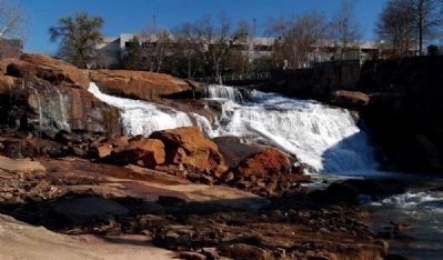
The proposed Reedy River Park in an 8.13 acre plot of land which is located at the heart of present day Greenville. The site includes the forty foot high Reedy River Falls and a secondary set of rapids in a rocky gorge downstream from these. The riverbank portion of the park includes the old Furman University botanical gardens and arboretum as well as the ruins of an early mill.
The 8.13 acre park includes six acres deeded to the City of Greenville by Furman University and some 2.13 acres of additional land. Most of this land lies below the Reedy River falls and provides an extremely desirable open space in this metropolitan area.
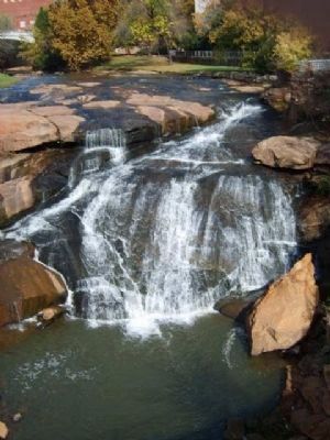
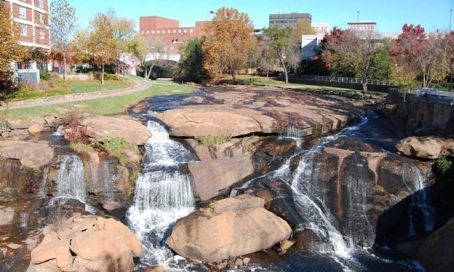
The Reedy River Falls lie just southeast of the South Main Street bridge and form the northernmost attraction of the park. At this point, the Reedy River plunges over a forty-foot drop into a rocky gorge which is defined on one side by the steep, rocky and heavily-wooded Camperdown Bluff. Within this area, a secondary set of falls can be found. These rapids were of key importance in the development of Greenville. Some brick ruins, presumed to be the remains of Vardry Mill built ca. 1830, are still visible on the riverbank at this point. The wide granite outcroppings below the main falls will be used for picnic facilities, walkways and footpaths. The low-lying land immediately west of this point was developed forty years ago as a botanical garden and arboretum by Furman University. The University which is no longer located in this area of Greenville has deeded these six acres of land to the city for the proposed park. Although some of the shrubs and trees of the early planting are still evident, the area has largely reverted to its natural state.
The City of Greenville has undertaken to maintain the immediate area. Overhead lighting and underground water connections are being installed. Projects are underway to clear the area of underbrush, excavate the sites of archeological importance and curtail riverbank erosion by the rapidly moving stream. Trails, walkways, footpath and picnic areas will complete the park's development.
Significance
The Reedy River Falls are not only the geographical but also the historical center of Greenville. The speed and power of the falls and the rapids below them were indirectly responsible for the founding of the city in 1812 when the city's first building, a grist mill, was built at this site. Since that time, the mills that were the economic life of the town sat near the falls and used their power to grind flour or manufacture textiles.
Industrial Significance
The land immediately surrounding the Reedy River Falls was deeded to one Richard Pearis just prior to the American Revolutionary War. Reaction by his neighbors to his Tory-Loyalist sympathies forced him to leave the area hurriedly. The only trace of his having been there at all is the fact that his name (despite a change in spelling) has been attached to nearby Paris Mountain. The following owner, Lemuel Alston, remained in control of the land until 1815. He was a representative in the South Carolina legislature in 1789 and was responsible for the establishment of a corn and grist mill at the head of Reedy River Falls in 1812. Traditionally, this has become the date of the founding of Pleasantburg. In 1815, the tract which had increased by then to 11,018 acres was sold to Vardry McBee. The remains of a granite and brick mill which he built on the lower falls in the l830s can still be discerned. The surrounding town of Pleasantburg continued to prosper with income derived from its thriving industry and in its 1831 charter the town changed its name to Greenville. The continuing growth of the town enticed further industry. The construction of the Camperdown Mills in 1870 was responsible for the decline of the falls and the eventual erosion of the banks below the mill outlets.
Rehabilitation of the area began with the opening of the Furman University botanical garden and arboretum in 1929-30. Since 1967, the Carolina Foothills Garden Club and the City of Greenville have been working to make the central part of this acreage suitable for a recreational park. (Source: Original National Register nomination form.)
— Submitted April 21, 2010, by Brian Scott of Anderson, South Carolina.
3. Reedy River Falls Historic Park and Greenway II
The Reedy River Park is a 14 acre property located at the heart of present day Greenville. The site includes the 50 foot Reedy River Falls and a secondary set of rapids in a rocky gorge downstream from these. The riverbank portion of the park includes the old Furman University botanical gardens and arboretum as well as the ruins of an early mill.
The park contains 6 acres deeded to the City of Greenville by Furman University and some 8 acres of additional land purchased by the City. Most of the property lies below the Reedy River Falls and provides an extremely desirable open space in this metropolitan area.
The Reedy River Falls lie just southeast of the South Main Street bridge and form the northernmost attraction of the park. At this point, the Reedy River plunges over a 50 foot drop into a rocky gorge which is defined on one side by the steep, rocky and heavily wooded Camperdown Bluff. Within this area a secondary set of falls can be found. These rapids were of key importance in the development of Greenville. Some brick ruins, presumed to be the remains of Vardry Mill built circa 1830, are still visible on the riverbank at this point. The wide granite outcroppings below the main falls are used for picnic facilities, walkways and footpaths. The low lying land immediately west of this point was developed ca. 1930 as a botanical garden and arboretum by Furman University.
The City of Greenville and the Carolina Foothills Garden Club have undertaken the development and maintenance of the area. Overhead lighting and underground water connections have been installed. Trails, walkways, and picnic areas have been constructed along the riverbanks. A 2.2 mile bike path has been constructed, connecting Reedy River Park with Cleveland Park, another city park. (These additions have not destroyed the historical integrity of the site.) In addition, a 19th Century structure known as the Falls Cottage has been renovated. It is being used cooperatively by the Greenville Metropolitan Arts Council, the Carolina Foothills Garden Club, and the Greenville Artists Guild.
Because the original nomination did not clearly delineate the nominated property and because the property has undergone changes, the nomination has been revised to clearly define the boundaries and to reflect the enlarged acreage.
Significance
The Reedy River Falls are not only the geographical but also the historical center of Greenville. The speed and power of the falls and rapids below them were indirectly responsible for the founding of Greenville at this site in the early 1800's. Since that time, the mills that were the economic life of the city sat near the falls and used their power to grind flour and cornmeal or manufacture textiles. In the 1930's, the area surrounding the falls acquired additional significance as the site of a botanical garden and arboretum. Today, the falls are being preserved and the surrounding area developed as the Reedy River Falls Historic Park and Greenway.
Industry
The land immediately surrounding the Reedy River Falls was granted to Richard Pearis just prior to the American Revolution. The first white settler known in the area, Pearis established a grist mill and Indian trading post next to the falls. Reaction by his neighbors to his Tory-Loyalist sympathies forced him to leave the area hurriedly, his property later being confiscated by the State of South Carolina.
After changing hands several times, the property was deeded to Lemuel J. Alston in 1788. Alston remained in control of the land until 1815 when the tract which had increased to 11,018 acres was sold to Vardry McBee. The Town of Pleasantburg having been founded in 1812, McBee began development of the area with the construction of two mills, the remains of which can still be discerned. The surrounding Town of Pleasantburg continued to prosper with income derived from its thriving industry and in its 1831 charter, the town changed its name to Greenville. The continuing growth of the town enticed further industry. The construction of the Camperdown Mills about 1870 was responsible for the decline of the area surrounding the falls and the eventual erosion of the banks below the mill outlet. (These mills are no longer extant.)
Conservation
The rocky gorge and bluff site below old Camperdown Mills have profuse and distinctive natural foliage, helping to produce an area described in 1907 as "the most distinctive feature of the topography and landscape of the City of Greenville." Rehabilitation of the area began with the opening of the Furman University botanical garden and arboretum in 1929-30. Since 1967, the Carolina Foothills Garden Club and the City of Greenville have been working to develop the park. The gorge and falls site now serve as a focal point of the greenway and bike path which connect Reedy River Park and Cleveland Park, another municipal recreational facility. Preservation of this area is therefore not only of historical importance, but also provides a valuable recreational asset for downtown Greenville. (Source: Revised National Register nomination form.)
— Submitted April 21, 2010, by Brian Scott of Anderson, South Carolina.
Credits. This page was last revised on October 5, 2021. It was originally submitted on April 19, 2010, by Brian Scott of Anderson, South Carolina. This page has been viewed 1,706 times since then and 43 times this year. Last updated on September 18, 2021, by Anonynous of Easley, South Carolina. Photos: 1, 2, 3. submitted on April 19, 2010, by Brian Scott of Anderson, South Carolina. 4. submitted on March 28, 2009, by Brian Scott of Anderson, South Carolina. 5. submitted on September 13, 2009, by Brian Scott of Anderson, South Carolina. 6. submitted on April 20, 2010, by Brian Scott of Anderson, South Carolina. 7, 8. submitted on November 21, 2008, by Brian Scott of Anderson, South Carolina. 9. submitted on March 3, 2010, by Brian Scott of Anderson, South Carolina. 10. submitted on March 30, 2009, by Brian Scott of Anderson, South Carolina. • J. Makali Bruton was the editor who published this page.
