Kinston in Lenoir County, North Carolina — The American South (South Atlantic)
Battle of Kinston
Federals Turn the Confederate Flank
— Foster's Raid —
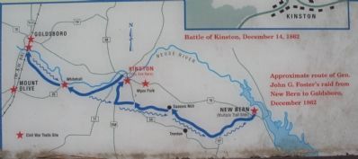
(Preface): Late in 1862, Union Gen. John G. Foster's garrison was well entrenched in New Bern and made several incursions into the countryside. On December 11, Foster led a raid from New Bern to burn the Wilmington and Weldon Railroad Bridge over the Neuse River at Goldsboro and to demonstrate in support of Gen. Ambrose E. Burnside's attack at Fredericksburg, Virginia. Foster's force consisted of 10,000 infantry, 650 cavalry, and 40 cannons.
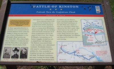
As Foster approached Kinston on December 13, he encountered Confederate defensive forces under Gen. Nathan G. Evans six miles southwest of here at Woodington on the Wilmington Road (present-day U.S. Route 258). After a fierce fight, Evans withdrew to earthworks here near the Neuse River and prepared for Foster's second attack, which came about 9 a.m. on December 14.
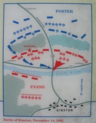
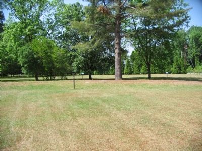
Evans stationed about 2,000 troops from the Carolinas here in a semicircular position extending from the river on your left about a mile to a swamp across Wilmington Road to your right. You are standing where the South Carolinians stood. Foster positioned his men for the attack in front of you. Gen. Henry W. Wessells, commanding one of Foster's brigades, divided his unit to attack Evans' left flank here. The Federals encountered thick woods, brambles, and a determined resistance. Eventually, however, with superior numbers and heavy artillery fire, they succeeded in breaking through the Confederate left flank. The South Carolinians gave way, crossing the Jones bridge (which stood just downstream from the modern one) into Kinston. Evans ordered the bridge set afire before the North Carolinians, on the right flank, had a chance to cross over, and many of them were captured as they fled in panic. After a brief stand on the north side of Kinston, Evans withdrew his troops. Foster and his men spent the night of December 14 in Kinston and departed for Goldsboro the next morning.
Erected by North Carolina Civil War Trails.
Topics and series. This historical marker is listed in this topic list: War, US Civil. In addition, it is included in the North Carolina Civil War Trails series list. A significant historical month for this entry is December 1989.
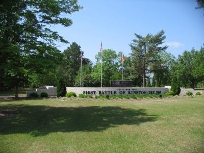
Location. 35° 14.387′ N, 77° 34.872′ W. Marker is in Kinston, North Carolina, in Lenoir County. Marker is at the intersection of Meadowbrook Drive and Harriette Drive, on the right when traveling north on Meadowbrook Drive. Located at the First Battle of Kinston Civil War site and memorial. The site is stop 10 on the First Battle of Kinston driving tour. Touch for map. Marker is in this post office area: Kinston NC 28504, United States of America. Touch for directions.
Other nearby markers. At least 8 other markers are within walking distance of this marker. In Honor and Remembrance (a few steps from this marker); Lenoir County Confederate Memorial (a few steps from this marker); Richard Caswell Gatlin (approx. 0.3 miles away); North Carolina (approx. 0.3 miles away); Starr's Battery (approx. 0.3 miles away); The Union Artillery (approx. 0.4 miles away); Foster's Raid (approx. 0.4 miles away); Wessells' Advance—December 14, 1862 (approx. 0.4 miles away). Touch for a list and map of all markers in Kinston.
More about this marker. On the lower left are portraits of Gens. Foster, Wessells, and Evans. On the right is a map showing the tactical situation in the middle phase of the battle. In the lower right is a map showing the Approximate route of Gen. John G. Foster's raid from New Bern to Goldsboro, December 1862.
Also see . . . Explore Civil War Battlefields in Kinkson and Goldborough. Visit North Carolina website entry (Submitted on May 19, 2023, by Larry Gertner of New York, New York.)
Photographed By Craig Swain, May 2, 2010
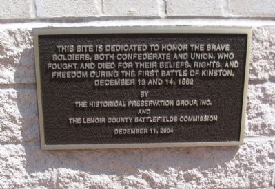
6. Dedication Plaque at the Site
soldiers, both Confederate and Union, who
fought and died for their beliefs, rights, and
freedom during the first battle of Kinston,
December 13 and 14, 1862
by
the Historical Preservation Group, Inc.,
and
the Lenoir County Battlefields Commission
December 11, 2004.
Photographed By Craig Swain, May 2, 2010
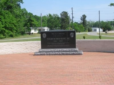
7. Wilbur Fred King, III Memorial
to the memory of
Wilbur Fred King, III
1966 - 2003
Wil king touched the lives of many people in his quest to preserve
Lenoir County's Civil War Battlefields
Wil's great love for history and his leadership were an inspiration
and a driving force in the preservation endeavors of this community.
Credits. This page was last revised on May 19, 2023. It was originally submitted on May 9, 2010, by Craig Swain of Leesburg, Virginia. This page has been viewed 1,577 times since then and 46 times this year. Photos: 1, 2, 3, 4, 5, 6, 7, 8. submitted on May 9, 2010, by Craig Swain of Leesburg, Virginia.
