Belton in Anderson County, South Carolina — The American South (South Atlantic)
The Belton Standpipe
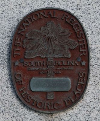
of Historic Places:
The Belton
Standpipe
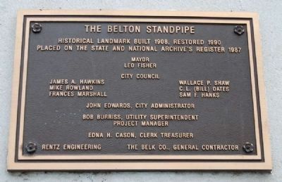
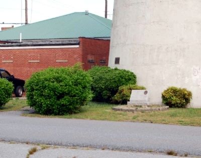
Dedication Plaque:
Historical Landmark Built 1908, Restored 1990
Placed on the State and National Archive's Register 1987
Mayor
Leo Fisher
City Council
James A. Hawkins, Wallace P. Shaw
Mike Rowland, C.L. (Bill) Oates
Francis Marshall, Sam F. Hanks
John Edwards, City Administrator
Bob Burris, Utility Superintendent
Project Manager
Edna H. Cason, Clerk Treasurer
Rentz Engineering, The Belk Co., General Contractor
Erected 1987 by Pendleton District Historical and Recreational Commission.
Topics. This historical marker is listed in this topic list: Landmarks. A significant historical year for this entry is 1908.
Location. 34° 31.333′ N, 82° 29.5′ W. Marker is in Belton, South Carolina, in Anderson County. Marker is on McGee Way near Campbell Street, on the left when traveling east. Touch for map. Marker is in this post office area: Belton SC 29627, United States of America. Touch for directions.
Other nearby markers. At least 10 other markers are within 5 miles of this marker, measured as the crow flies. Belton / Historic Belton (about 600 feet away, measured in a direct line); Greenville & Columbia RR / Belton (about 600 feet away); Belton Depot (about 700 feet away); Chamberlain-Kay House (about 800 feet away); Belton Academy / Central School (approx. 0.3 miles away); First Baptist Church of Belton (approx. 0.4 miles away); Belton Veterans Memorial (approx. 0.6 miles away); Rocky River Baptist Association Headquarters (approx. 1.6 miles away); Dorchester Baptist Church World War II Veterans Plaque (approx. 2.3 miles away); Cooley's Bridge (approx. 4.9 miles away). Touch for a list and map of all markers in Belton.
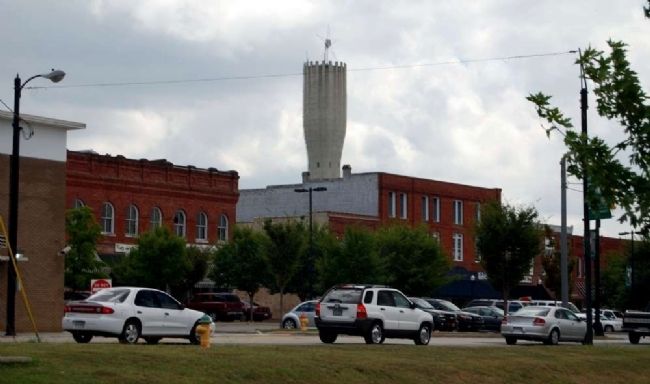
Also see . . . Belton Standpipe. The Belton Standpipe is a 155-foot high concrete water tower located one block east of the central business district of Belton. (Submitted on May 25, 2010, by Brian Scott of Anderson, South Carolina.)
Additional commentary.
1. Belton Standpipe
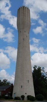
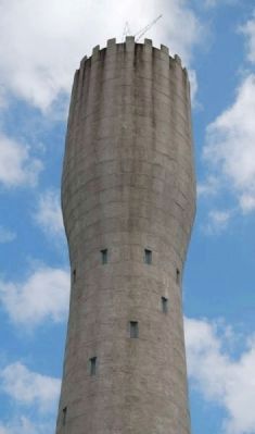
The Belton Standpipe is a 155-foot high concrete water tower located on McGee Street near the intersection of Campbell Street, one block east of the central business district of Belton. The standpipe, which was constructed in 1908-09, is basically unaltered although the exterior has weathered. Minor alterations include the sealing of the windows and the erection of a metal star, lighted only at Christmas, on top of the tower.
Additional Information
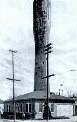
The Belton Standpipe continues in use as a water storage source. The upper fifty-five feet of the tower serve as a reservoir with a capacity of 165,000 gallons. The tower is freestanding and of concrete construction in segmented rings. The rings were created by the pouring of concrete in stages, giving the effect of stone construction.
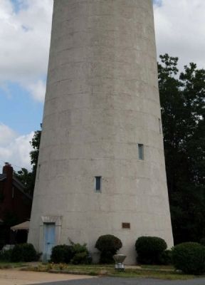
The structure extends thirty feet into the ground, widening out in a funnel shape. From the ground level, where it is forty-four feet in diameter, the standpipe tapers inward for 100 feet to the point where the water tower begins. From that point the tower ranges outward again to thirty feet in diameter and upward fifty-five feet to the cap, crowned by crenelations. Window openings, now sealed with plywood to keep birds and insects out, are clearly evident and were indented to provide light and ventilation during construction. There are no stairs on the interior, as with some other towers of this type.
A ground level entrance to a storage area is framed by a classical, proportional door surround containing a lintel with simulated radiating voussoirs. There is an exterior ladder on the north side, beginning twelve feet from the ground and extending to the top.
Water flows through a ten-inch cast-iron pipe in the center of the structure. Deep wells, located under the standpipe and once used to supply the municipality's water, are no longer used. While it is commonly known as the "Belton Standpipe," the structure is actually a water tower, as a standpipe normally stores water its entire length.
Surroundings: Commercial buildings face the streets on O'Neal and Campbell Streets. Privately-owned property adjoins the site on McGee Street.
Significance
The Belton Standpipe, a 155-foot tall concrete tower built for the town's water supply, is the major landmark for the Anderson County town of Belton. It is significant as one of the state's earliest extant examples of water storage facilities in concrete construction, which gained popularity in the United States in the early twentieth century. It is also significant as an intact remnant of and symbol of an important period of growth and development in the town's history.
Additional Information
The town of Belton grew rapidly in the late nineteenth and early twentieth centuries; the population rose from 494 in 1892 to 1,652 in 1910. By 1908 citizens had decided that a municipal water system was needed. In an election on May 12, 1908, voters gave the Belton Town Council approval to issue bonds in the amount of $12,500.000 to erect a plant for the waterworks. The town had purchased one-third of an acre in 1907 for the site. J.C. McCurray, a contractor, was chosen to prepare plans and construct the standpipe. Work began in 1908 and the structure was 100 feet high by January 3, 1909. Bonds were not issued, however, until January 1, 1909, after ratification by the South Carolina General Assembly. When completed, the Belton Standpipe had a capacity of 165,000 gallons of water.
There is a similar water tower in Walterboro, S.C., which was built in 1915; it is 132 feet high and has a capacity of 100,000 gallons. Belton and Walterboro have the only two water towers of this type yet to be identified in South Carolina.
Community Planning/Engineering
As populations became more concentrated in communities in the late nineteenth and early twentieth centuries, numerous municipalities constructed water works facilities. Elevated storage tanks were an important part of these municipal water systems. These structures also were symbols of municipal improvement and reflected the prosperity and progressive outlook of their sponsors. The use of picturesque architecture both contrasted with and provided a means by which the public could accept technological changes in construction techniques, while allowing the greatest freedom for the engineer and the designer. Aesthetic concerns in architectural treatments can be found in such contemporaneous publications as Designs for Water Towers, Pumping and Power Stations (1893) and Elevated Tank Designs (1931). The first decade of the twentieth century brought reinforced concrete into use in the construction of water storage facilities. It was thought to be a substitute for steel, to be "durable, inexpensive and attractive...with the insulating qualities of brick." (Source: National Register nomination form.)
— Submitted June 17, 2010, by Brian Scott of Anderson, South Carolina.
Credits. This page was last revised on October 14, 2020. It was originally submitted on May 25, 2010, by Brian Scott of Anderson, South Carolina. This page has been viewed 1,629 times since then and 46 times this year. Photos: 1, 2, 3, 4, 5, 6, 7, 8, 9. submitted on May 25, 2010, by Brian Scott of Anderson, South Carolina. 10. submitted on October 7, 2010, by Brian Scott of Anderson, South Carolina.
