Near Snow Hill in Greene County, North Carolina — The American South (South Atlantic)
Grimsley Baptist Church
Rest, Feed, and Forage
— Potter's Raid —
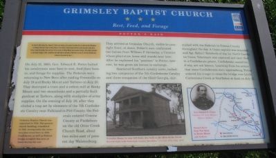
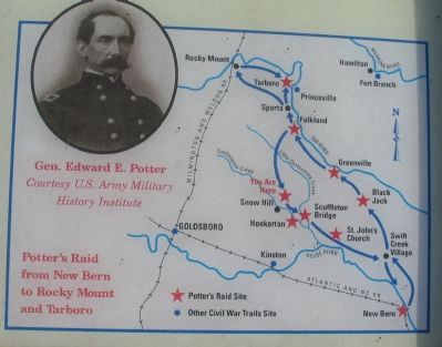
On July 21, 1863, Gen. Edward E. Potter halted his cavalrymen near here to rest, feed their horses, and forage for supplies. The Federals were returning to New Bern after raiding Greenville on July 19 and Rocky Mount and Tarboro on July 20. They destroyed a train and a cotton mill at Rocky Mount and two steamboats and a partially built gunboat at Tarboro, along with stockpiles of army supplies. On the evening of July 20, after they eluded a trap set by elements of the 7th Confederate Cavalry near Falkland in Pitt County, the Federals entered Greene County at Fieldsboro on the old Otter Creek Church Road, about two miles east of present day Walstonburg. They arrived at Grimsley Church, visible to your right front, at dawn. Potter's men confiscated two horses from William P. Grimsley, a Unionist whose plantation home still stands near here. After he explained his "position" to Potter, however, he was given six horses in exchange.
Scattered cavalry units, including two companies of the 7th Confederate Cavalry and three companies of the 62nd Georgia, skirmished with the Federals in Greene County throughout the day. A Union captain was wounded and Sgt. Robert Striebeck of the 1st North Carolina Union Volunteers was captured and later died in a Confederate prison. Confederate casualties, if any, are not known. Learning from his scouts that more Confederates were approaching, Potter ordered his troops to cross the bridge over Little Contentnea Creek at Scuffleton at dusk on July 21.
(Lower Left Sidebar): Grimsley Baptist Church was organized in 1752. The present church building, remodeled in 1951, incorporates the structure that stood here in 1863. Confederates as well as Federal troops occupied this area at times during the war.
Erected by North Carolina Civil War Trails.
Topics and series. This historical marker is listed in this topic list: War, US Civil. In addition, it is included in the North Carolina Civil War Trails series list. A significant historical date for this entry is July 18, 1863.
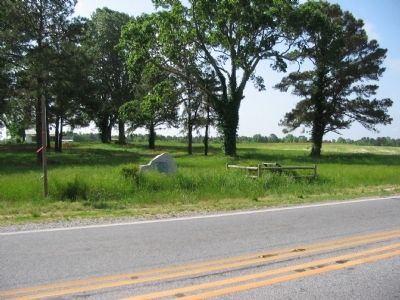
Location. 35° 28.883′ N, 77° 38.33′ W. Marker is near Snow Hill, North Carolina, in Greene County. Marker is at the intersection of U.S. 13 (U.S. 258) and County Route 903, on the right when traveling north on U.S. 13. Touch for map. Marker is at or near this postal address: 2856 US-13, Snow Hill NC 28580, United States of America. Touch for directions.
Other nearby markers. At least 8 other markers are within 9 miles of this marker, measured as the crow flies. Hull Road (here, next to this marker); Snow Hill (approx. 2˝ miles away); Tuscarora War (approx. 2˝ miles away); Nooherooka (approx. 5 miles away); James Glasgow (approx. 5.8 miles away); Farm Bell (approx. 8.4 miles away); Chasing Gen. Potter (approx. 8.4 miles away); Gen. Allen Hal Turnage (approx. 8˝ miles away). Touch for a list and map of all markers in Snow Hill.
More about this marker. In the lower center is a photo of the church. Grimsley House, to your left front, was built in the 1850s in the Greek Revival style with Italianate cornice brackets. On the lower right is a map showing key points in the raid, with a portrait of General Potter.
Credits. This page was last revised on May 11, 2023. It was originally submitted on May 25, 2010, by Craig Swain of Leesburg, Virginia. This page has been viewed 1,791 times since then and 69 times this year. Last updated on May 7, 2023, by Michael Buckner of Durham, North Carolina. Photos: 1, 2, 3. submitted on May 25, 2010, by Craig Swain of Leesburg, Virginia. • J. Makali Bruton was the editor who published this page.


