Bristol in Bucks County, Pennsylvania — The American Northeast (Mid-Atlantic)
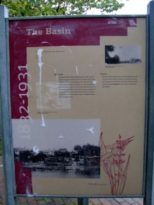
The Basin
1832 - 1931
[parts of quote illegible] “T___ ___ seemed to be a solid mass of boats.”
W.H. ____
Mule ____
Waiting
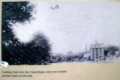
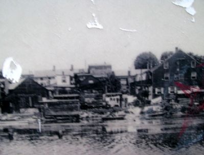
The five acre Bristol Basin provided a place to wait. Located between Lock No. 1 and the Tidal Lock, the Basin stored boats waiting to continue on to Philadelphia and New York City as well as others waiting to be unloaded and then reloaded for a return trip up the Canal. Coal and lumber yards developed near the top end of the Basin so that loads could be transported to local suppliers. Abandoned Canal boats still wait in the Basin, covered since 1931 by a parking lot built on dredged material from the Delaware River.
Today
Workmen created the Basin out of a natural wetland that was once part of Bristol Marsh. A portion of the Marsh still exists and is preserved by the Nature Conservancy. The former Basin is now a municipal parking lot and its edge is outlined with blue bollards.
Erected by Bristol Borough, Pennsylvania Department of Conservation and Natural Resources, and the Delaware & Lehigh National Heritage Corridor.
Topics and series. This historical marker is listed in these topic lists: Industry & Commerce • Waterways & Vessels . In addition, it is included in the Delaware Canal (AKA Delaware Division of the Pennsylvania Canal) series list. A significant historical year for this entry is 1931.
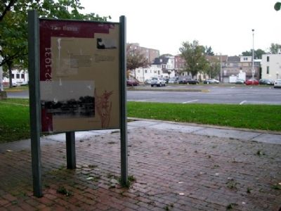
Location. This marker has been replaced by another marker nearby. It was located near 40° 5.631′ N, 74° 51.481′ W. Marker was in Bristol, Pennsylvania, in Bucks County. Marker is located in Basin Park, near the confluence of Otter Creek and the Delaware River, about 500 feet WSW of the intersection of Mill and Radcliffe Streets. Touch for map. Marker was in this post office area: Bristol PA 19007, United States of America. Touch for directions.
Other nearby markers. At least 8 other markers are within walking distance of this location. In the Basin (here, next to this marker); Fueling the Economy (here, next to this marker); Working with the Tide (here, next to this marker); Marsh Ecology in an Urban Setting (within shouting distance of this marker); Where the Canal Met the River (within shouting distance of this marker); Harriet Ross Tubman (within shouting distance of this marker); Tidal Delaware Water Trail (within shouting distance of this marker); The Puerto Rican Monument of Bristol (within shouting distance of this marker). Touch for a list and map of all markers in Bristol.
Related marker. Click here for another marker that is related to this marker. This marker has been replaced by the
linked marker.
Also see . . .
1. History of Bristol Borough. (Submitted on May 28, 2010, by William Fischer, Jr. of Scranton, Pennsylvania.)
2. Delaware Canal State Park Field Guide. (Submitted on May 28, 2010, by William Fischer, Jr. of Scranton, Pennsylvania.)
Credits. This page was last revised on November 15, 2020. It was originally submitted on May 28, 2010, by William Fischer, Jr. of Scranton, Pennsylvania. This page has been viewed 927 times since then and 63 times this year. Photos: 1, 2, 3, 4. submitted on May 28, 2010, by William Fischer, Jr. of Scranton, Pennsylvania.


