Henrico in Henrico County, Virginia — The American South (Mid-Atlantic)
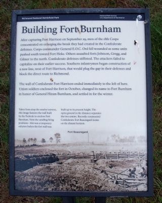
Building Fort Burnham
After capturing Fort Harrison on September 29, men of the 18th Corps concentrated on enlarging the break they had created in the Confederate defenses. Corps commander General E.O.C. Ord fell wounded as some units pushed south toward Fort Hoke. Others assaulted forts Johnson, Gregg, and Gilmer to the north. Confederate defenses stiffened. The attacks failed to capitalize on their earlier success. Southern infantrymen began construction of a new line, west of Fort Harrison, that would plug the gap in their defenses and block the direct route to Richmond.
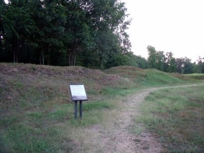
The wall of Confederate Fort Harrison ended immediately to the left of here. Union soldiers enclosed the fort in October, changed its name to Fort Burnham in honor of General Hiram Burnham, and settled in for the winter.
Taken from atop the nearby traverse, this image features the wall built by the Federals to enclose Fort Burnham. Note the sandbag firing positions-this was a temporary solution before the fort wall was built up to its present height. The open ground in the distance separates the two armies. Recently constructed Confederate Fort Beauregard looms on the distant horizon.
Erected 2010 by Richmond National Battlefield Park.
Topics. This historical marker is listed in these topic lists: Forts and Castles • War, US Civil. A significant historical month for this entry is September 1864.
Location. 37° 25.591′ N, 77° 22.418′ W. Marker is in Henrico, Virginia, in Henrico County. Marker can be reached from Battlefield Park Road, 0.2 miles south of Picnic Road. Touch for map. Marker is in this post office area: Henrico VA 23231, United States of America. Touch for directions.
Other nearby markers. At least 8 other markers are within walking distance of this marker. Well (a few steps from this marker); Storming the Fort (within shouting distance of this marker); The Fort Parapet (within shouting distance of this marker); Bombproof (within shouting distance of this marker); Bombproof and Casemate (within shouting distance of this marker); Counterattack (within shouting distance of this marker); A Unique Photograph (about 300 feet away, measured in a direct line); Grant Under Fire (about 400 feet away). Touch for a list and map of all markers in Henrico.
Also see . . .
1. Richmond National Battlefield Park. National Park Service website entry (Submitted on July 12, 2010, by Bernard Fisher of Richmond, Virginia.)
2. Old Marker at this Location. This marker replaced an older one at this location titled "The Fort Parapet" (Submitted on July 12, 2010, by Bernard Fisher of Richmond, Virginia.)
Credits. This page was last revised on April 9, 2024. It was originally submitted on July 12, 2010, by Bernard Fisher of Richmond, Virginia. This page has been viewed 874 times since then and 26 times this year. Photos: 1, 2. submitted on July 12, 2010, by Bernard Fisher of Richmond, Virginia.

