Annandale in Fairfax County, Virginia — The American South (Mid-Atlantic)
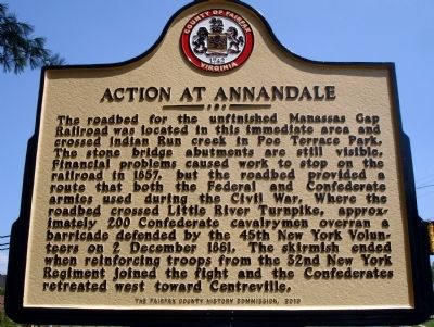
Action At Annandale
Erected 2010 by The Fairfax County History Commission.
Topics and series. This historical marker is listed in these topic lists: Railroads & Streetcars • War, US Civil. In addition, it is included in the Manassas Gap Railroad, and the Virginia, Fairfax County History Commission series lists. A significant historical date for this entry is December 2, 1861.
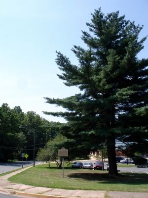
Location. 38° 49.695′ N, 77° 11.14′ W. Marker is in Annandale, Virginia, in Fairfax County. Marker is at the intersection of Little River Turnpike (Virginia Route 236) and Hillbrook Drive, on the right when traveling east on Little River Turnpike. Marker is located at the George Mason Regional Library. Touch for map. Marker is at or near this postal address: 7001 Little River Turnpike, Annandale VA 22003, United States of America. Touch for directions.
Other nearby markers. At least 8 other markers are within 2 miles of this marker, measured as the crow flies. The Cannon (approx. half a mile away); Little River Turnpike (approx. 0.6 miles away); Mason's Hill (approx. 0.8 miles away); Price’s Ordinary (approx. 1.1 miles away); a different marker also named Mason’s Hill (approx. 1.4 miles away); Historic Green Spring (approx. 1.4 miles away); Mosby Attacks Annandale (approx. 1˝ miles away); Mount Pleasant Baptist Church (approx. 1.6 miles away). Touch for a list and map of all markers in Annandale.
Also see . . . Skirmish at Annandale, Va. Official Reports: No.1. Brig. Gen. Louis Blenker, U.S. Army No.2. Maj. Alonzo W. Adams, First New York Cavalry No.3. Brig. Gen. William B. Franklin, U.S. Army No.4. Brig. Gen. John Newton, U.S. Army (Submitted on July 24, 2010.)
Credits. This page was last revised on July 7, 2021. It was originally submitted on July 24, 2010. This page has been viewed 2,765 times since then and 94 times this year. Photos: 1, 2. submitted on July 24, 2010. 3, 4. submitted on January 15, 2011. • Craig Swain was the editor who published this page.


