Stewartsville in Franklin Township in Warren County, New Jersey — The American Northeast (Mid-Atlantic)
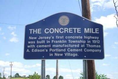
The Concrete Mile
Inscription.
New Jersey's first concrete highway was built in Franklin Township in 1912 with cement manufactured at Thomas A. Edison's Portland Cement Company in New Village.
Topics. This historical marker is listed in this topic list: Roads & Vehicles. A significant historical year for this entry is 1912.
Location. 40° 42.638′ N, 75° 5.987′ W. Marker is in Franklin Township, New Jersey, in Warren County. It is in Stewartsville. Marker is on Washington Avenue (New Jersey Route 57 at milepost 3), on the right when traveling east. This marker is located near the township line, in Franklin Township, Warren County, near Greenwich Township. Touch for map. Marker is in this post office area: Stewartsville NJ 08886, United States of America. Touch for directions.
Other nearby markers. At least 8 other markers are within 4 miles of this marker, measured as the crow flies. Morris Canal Bread Lock No 7 West (approx. 0.4 miles away); Edison Portland Cement Company (approx. half a mile away); Honor Roll (approx. 1.3 miles away); Inclined Plane / Morris Canal Inclined Plane No 9 West (approx. 2.4 miles away); Greenwich Township Veterans Monument (approx. 3.3 miles away); Old Greenwich Cemetery (approx. 3.3 miles away); General William Maxwell (approx. 3.3 miles away); Bloomsbury Veterans Monument (approx. 3.8 miles away).
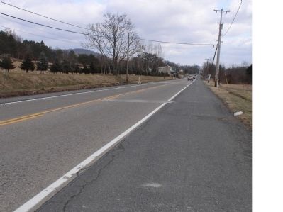
Regarding The Concrete Mile. Edison's original concrete road was replaced years ago. At that time, 3 blocks from the original road were placed in the new road. However, as of 2010, those blocks are gone.
Credits. This page was last revised on April 20, 2023. It was originally submitted on January 14, 2010, by Dorine Ruth Emery of Washington, New Jersey. This page has been viewed 10,396 times since then and 323 times this year. Last updated on July 27, 2010, by John Ben Urban of Middletown, Delaware. Photos: 1. submitted on August 26, 2010, by John Ben Urban of Middletown, Delaware. 2. submitted on January 20, 2010, by Dorine Ruth Emery of Washington, New Jersey. • Kevin W. was the editor who published this page.

