Nyack in Rockland County, New York — The American Northeast (Mid-Atlantic)
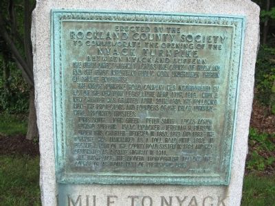
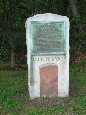
1 Mile To Nyack
Rockland County Society
To commemorate the opening of the
Nyack Turnpike
Between Nyack and Suffern
The Nyack Turnpike Road Company was incorporated by act of the New York Legislature April 17th, 1816. When a new charter was granted, April 20th, 1830, the following men – the projectors and founders of the Nyack Turnpike were appointed trustees:
Tunis Smith John Green Peter Smith Lucas Acker Edward Suffern Isaac Lydacker Jeremiah H. Pierson
Under this charter – renewed in 1853, 1873 and 1883 – the turnpike was maintained as a toll road unntil 1893. It became a part of the county road system in 1894 and was designated as a state highway in 1911.
At this place, the modern thoroughfare follows the course of an Indian path of prehistoric days.
October, 1926
Erected 1926 by Rockland County Society.
Topics and series. This historical marker is listed in this topic list: Roads & Vehicles. In addition, it is included in the New York, Historical Society of Rockland County series list. A significant historical date for this entry is April 17, 1882.
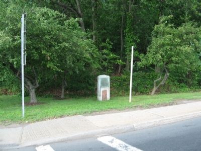
Location. 41° 5.668′ N, 73° 56.154′ W. Marker is in Nyack, New York, in Rockland County. Marker is at the intersection of New York State Route 59 and Mountainview Avenue, on the right when traveling west on State Route 59. Touch for map. Marker is in this post office area: Nyack NY 10960, United States of America. Touch for directions.
Other nearby markers. At least 8 other markers are within walking distance of this marker. Rockland Brink's Robbery (within shouting distance of this marker); Historic Underground Railroad (approx. 0.4 miles away); Oak Hill Cemetery (approx. 0.4 miles away); a different marker also named Historic Underground Railroad (approx. 0.7 miles away); Stephen Rowe Bradley Sr. Park (approx. 0.7 miles away); Hopper House (approx. 0.9 miles away); First Reformed Church of Nyack (approx. one mile away); Couch Court (approx. one mile away). Touch for a list and map of all markers in Nyack.
Also see . . . The Historical Society of Rockland County. Society website homepage (Submitted on July 27, 2010, by Michael Herrick of Southbury, Connecticut.)
Credits. This page was last revised on August 26, 2021. It was originally submitted on July 27, 2010, by Michael Herrick of Southbury, Connecticut. This page has been viewed 1,258 times since then and 32 times this year. Photos: 1, 2, 3. submitted on July 27, 2010, by Michael Herrick of Southbury, Connecticut.


