Downtown in Norfolk, Virginia — The American South (Mid-Atlantic)
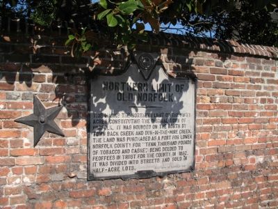
Northern Limit of Old Norfolk
Erected 1931 by City of Norfolk.
Topics. This historical marker is listed in these topic lists: Colonial Era • Settlements & Settlers. A significant historical year for this entry is 1682.
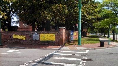
Location. 36° 50.82′ N, 76° 17.115′ W. Marker is in Norfolk, Virginia. It is in Downtown. Marker is at the intersection of St Paul's Boulevard and East City Hall Avenue, on the right when traveling north on St Paul's Boulevard. This markers sits on the wall that surrounds St Paul’s Church. Touch for map. Marker is in this post office area: Norfolk VA 23510, United States of America. Touch for directions.
Other nearby markers. At least 8 other markers are within walking distance of this marker. St. Paul’s Church, 1739 (about 400 feet away, measured in a direct line); East Main Street (about 600 feet away); Willoughby-Baylor House, 1794 (approx. 0.2 miles away); St. Joseph’s Catholic Church & School (approx. 0.2 miles away); Francis Drake, Free Black Barber (approx. 0.2 miles away); Commercial Place (approx. 0.2 miles away); Old City Hall and Courthouse, 1850 (approx. 0.2 miles away); Whitehead House, 1791 (approx. ¼ mile away). Touch for a list and map of all markers in Norfolk.
More about this marker. “Feoffees” is an old English law term roughly equivalent to today’s “trustee.” Marker was originally erected at the corner of Cove and Church Streets in the late 1920s or early 1930s. Cove Street no longer exists.
Credits. This page was last revised on October 26, 2023. It was originally submitted on November 6, 2007, by Laura Troy of Burke, Virginia. This page has been viewed 1,087 times since then and 31 times this year. Photos: 1. submitted on November 6, 2007, by Laura Troy of Burke, Virginia. 2. submitted on June 26, 2015, by Mike Wintermantel of Pittsburgh, Pennsylvania. • J. J. Prats was the editor who published this page.

