Near Chatsworth in Murray County, Georgia — The American South (South Atlantic)
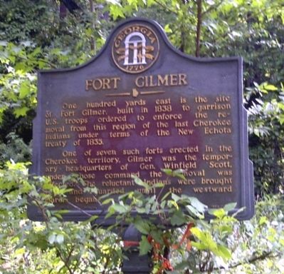
Fort Gilmer
One of seven such forts erected in the Cherokee territory, Gilmer was the temporary headquarters of Gen. Winfield Scott, under whose command the removal was effected. The reluctant Indians were brought here and guarded until the westward march began.
Erected 1953. (Marker Number 105-2.)
Topics and series. This historical marker is listed in these topic lists: Forts and Castles • Native Americans. In addition, it is included in the Georgia Historical Society series list. A significant historical year for this entry is 1838.
Location. 34° 39.661′ N, 84° 42.555′ W. Marker is near Chatsworth, Georgia, in Murray County. Marker is on Old U.S. 411, 1˝ miles south of U.S. 76. Touch for map. Marker is in this post office area: Chatsworth GA 30705, United States of America. Touch for directions.
Other nearby markers. At least 8 other markers are within 9 miles of this marker, measured as the crow flies. Old Federal Road (approx. 2 miles away); De Soto in Georgia (approx. 4.2 miles away); Old Holly Creek P.O. (approx. 6.8 miles away); Murray County (approx. 8.1 miles away); Wright Hotel (approx. 8.1 miles away); Mystery Shrouds Fort Mountain (approx. 8.1 miles away); Cohutta-Chattahoochee Scenic Byway (approx. 8.3 miles away); Fort Mountain (approx. 8.3 miles away). Touch for a list and map of all markers in Chatsworth.
Additional keywords. Trail of Tears, forced removal
Credits. This page was last revised on February 1, 2020. It was originally submitted on August 1, 2010, by David Seibert of Sandy Springs, Georgia. This page has been viewed 924 times since then and 39 times this year. Photo 1. submitted on August 1, 2010, by David Seibert of Sandy Springs, Georgia. • Craig Swain was the editor who published this page.
