Goliad in Goliad County, Texas — The American South (West South Central)
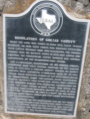
Regulators of Goliad County
Gen. J.J. Reynolds, commander of the Federal forces, appointed Jack Helm special marshal to the Goliad area in June 1868. A former deputy sheriff of DeWitt County, Helm captained a vigilante band of 50 men, mostly local ranchers, known as the Regulators. Based at Middletown (now Weesatche), these volunteers pursued criminals with vigor and often with cruelty. They ordered known and suspected lawbreakers to leave the state within 10 days. Those who defied the warning were shot without benefit of trial. In 1870 Helm was appointed by Gov. E.J. Davis to the newly formed state police force but was soon discharged for his ruthlessness.
The activities of the Regulators and of the Texas Rangers, reorganized under Gov. Richard Coke in 1874, did much to restore order in this area. By 1876, most of the violators had left, and the regulators were able to devote their time to ranching and farming.
Erected 1977 by Texas Historical Commission. (Marker Number 4236.)
Topics. This historical marker is listed in this topic list: War, US Civil. A significant historical month for this entry is April 1865.
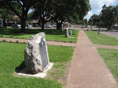
Location. 28° 39.956′ N, 97° 23.489′ W. Marker is in Goliad, Texas, in Goliad County. Marker is on South Market Street south of North Courthouse Square, on the right when traveling south. Touch for map. Marker is at or near this postal address: 127 North Courthouse Square, Goliad TX 77963, United States of America. Touch for directions.
Other nearby markers. At least 8 other markers are within walking distance of this marker. Don Rafael Antonio Manchola (a few steps from this marker); First Lieut. James H. Ewell Jr. Memorial (within shouting distance of this marker); Goliad County World War I Memorial (within shouting distance of this marker); Santa Anna's Surrender Ratified (within shouting distance of this marker); The Hanging Tree (within shouting distance of this marker); Goliad County Courthouse (within shouting distance of this marker); Neyland Building (within shouting distance of this marker); Goliad Global War Memorial (about 300 feet away, measured in a direct line). Touch for a list and map of all markers in Goliad.
Credits. This page was last revised on April 18, 2019. It was originally submitted on August 9, 2010, by Steve Gustafson of Lufkin, Texas. This page has been viewed 1,157 times since then and 42 times this year. Photos: 1, 2. submitted on August 9, 2010, by Steve Gustafson of Lufkin, Texas. • Craig Swain was the editor who published this page.

