Near Marlinton in Pocahontas County, West Virginia — The American South (Appalachia)
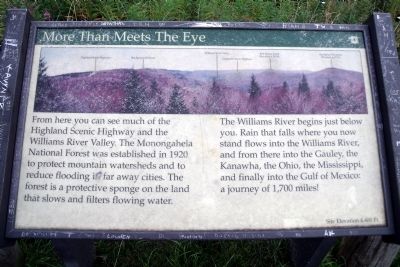
More Than Meets The Eye
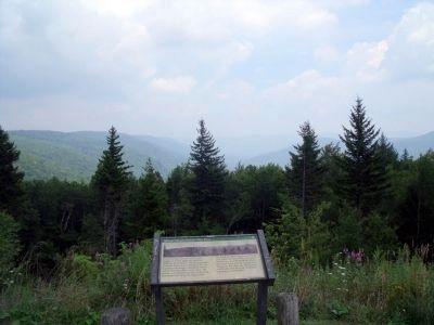
The Williams River begins just below you. Rain that falls where you now stand flows into the Williams River, and from there into the Gauley River, the Kanawha, the Ohio, the Mississippi, and finally into the Gulf of Mexico: a journey of 1,700 miles!
Site Elevation 4,400 Ft.
Erected by US Forest Service.
Topics. This historical marker is listed in these topic lists: Environment • Horticulture & Forestry. A significant historical year for this entry is 1920.
Location. 38° 14.804′ N, 80° 14.433′ W. Marker is near Marlinton, West Virginia, in Pocahontas County. Marker is on Highland Scenic Highway (West Virginia Route 150) 6.4 miles north of Bruffey Reserve (West Virginia Route 39), on the right when traveling north. Touch for map. Marker is in this post office area: Marlinton WV 24954, United States of America. Touch for directions.
Other nearby markers. At least 8 other markers are within 8 miles of this marker, measured as the crow flies. Black Mountain Fire (approx. 1˝ miles away); A History (approx. 4.4 miles away); Cranberry Glades (approx. 4.8 miles away); William L. "Mudwall" Jackson (approx. 6.9 miles away); Anna Wallace (approx. 6.9 miles away); Battle Of Mill Point (approx. 6.9 miles away); Mill Point (approx. 7 miles away); Natural History and Heritage (approx. 7.4 miles away).
Also see . . . Highland Scenic Highway. Forest Service, U.S. Department of Agriculture (Submitted on August 15, 2010.)
Credits. This page was last revised on November 14, 2021. It was originally submitted on August 15, 2010, by Bernard Fisher of Richmond, Virginia. This page has been viewed 570 times since then and 18 times this year. Photos: 1, 2. submitted on August 15, 2010, by Bernard Fisher of Richmond, Virginia.

