Falmouth in Stafford County, Virginia — The American South (Mid-Atlantic)
Bombardment
The Battle of Fredericksburg
— Fredericksburg and Spotsylvania National Military Park —
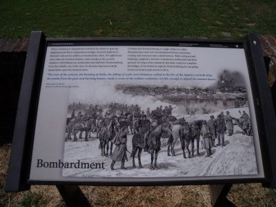
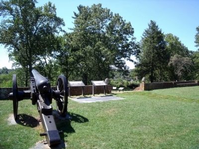
When Confederate sharpshooters blocked his efforts to span the Rappahannock River with pontoon bridges, General Ambrose E. Burnside ordered his artillery to bombard the town. For eight hours more than one hundred cannon, some as large as the 4.5-inch ordnance rifle behind you, hurled shot and shell into Fredericksburg from these bluffs, east of the river. In all, more than 6,000 shells rained down upon the doomed town.
Civilians fled Fredericksburg or sought shelter in cellars. Sharpshooters took over the abandoned houses and shops, turning each structure into a small fortress. Walls collapsed and buildings caught fire, but the Confederates stubbornly held their ground. As long as they remained, Burnside could not complete his bridges. If he wished to capture Fredericksburg, he was going to have to send troops across to do it.
“The roar of the cannon, the bursting of shells, the falling of walls and chimneys; added to the fire of the infantry on both sides, the smoke from the guns and burning houses, made a scene of the wildest confusion, terrific enough to appall the stoutest hearts.” Private John H. Rhodes, Battery B, 1st Rode Island Artillery
Erected 2010 by National Park Service, U.S. Department of the Interior.
Topics. This historical marker is listed in this topic list: War, US Civil.
Location. 38° 18.494′ N, 77° 27.367′ W. Marker is in Falmouth, Virginia, in Stafford County. Marker can be reached from Chatham Drive near Chatham Heights Road. Touch for map. Marker is at or near this postal address: 120 Chatham Lane, Fredericksburg VA 22405, United States of America. Touch for directions.
Other nearby markers. At least 8 other markers are within walking distance of this marker. Beleaguered Town (here, next to this marker); Union Soldiers View (here, next to this marker); Fredericksburg Campaign (here, next to this marker); Pontoon Bridges (a few steps from this marker); Between Battles (a few steps from this marker); A Bloody Crossing (a few steps from this marker); A “Picture of Desolation” (within shouting distance of this marker); Sow…Tend…Harvest (about 400 feet away, measured in a direct line). Touch for a list and map of all markers in Falmouth.
Related marker. Click here for another marker that is related to this marker. Old Marker At This Location titled "Fredericksburg Campaign".
Also see . . . Fredericksburg & Spotsylvania National Military Park. National Park Service (Submitted on September 7, 2010.)
Credits. This page was last revised on November 14, 2021. It was originally submitted on September 7, 2010, by Bernard Fisher of Richmond, Virginia. This page has been viewed 929 times since then and 13 times this year. Photos: 1, 2, 3, 4. submitted on September 7, 2010, by Bernard Fisher of Richmond, Virginia.


