Berkeley Hills in Alameda County, California — The American West (Pacific Coastal)
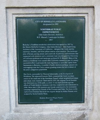
Northbrae Public Improvements
John Galen Howard, Architect; R.A. Mansell, Landscape Architect 1907
— City of Berkeley Landmark - designated in 1992 —
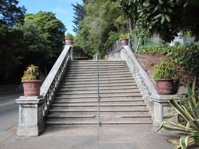
Berkeley's Northbrae residential subdivision was opened in 1907 by the Mason-McDuffie Company, John Galen Howard - then Supervising Architect of the University of California - designed the Circle and the stairways, benches, and stone pillars used as streetmarkers. The landscape of broad, curving streets and a network of pathways and staircases that connected with streetcars and a commuter train was designed by the University of California professor and landscape architect R.E. Mansell. Many of the streets in Nortbrae were named after California counties as part of a nearly successful effort to persuade the state legislators to move the capital from Sacramento to Berkeley. A number of parks sited around large natural rock outcroppings near the Circle contain grinding stones that are evidence of the area's indigenous population.
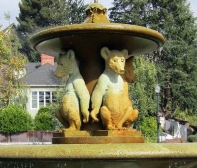
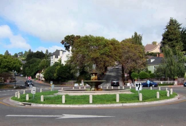
The Circle, surrounded by classical balustrades, is the focal point of Northbrae. The adjacent Fountain Walk connected The Circle to a train station at the south end of the Northbrae Tunnel, where neighborhood shops and a bank were clustered. Dedicated in 1911, the original Circle fountain was destroyed in a 1958 traffic accident. It was replicated through the efforts of North Berkeley residents with City cooperation and rededicated in 1996. More than 1,200 residents and friends contributed to the restoration campaign organized by Friends of the Fountain and Walk. The bears on the replacement fountain that recall the original design by Arthur Putnam were sculpted by Sarita Camille Waite.
Berkeley Historical Plaque Project
2003
Erected 2003 by Berkeley Historical Plaque Project.
Topics. This historical marker is listed in these topic lists: Architecture • Settlements & Settlers. A significant historical year for this entry is 1907.
Location. 37° 53.394′ N, 122° 16.338′ W. Marker is in Berkeley, California, in Alameda County. It is in Berkeley Hills. Marker is at the intersection of The Circle and Marin Avenue, on the right when traveling east on The Circle. Touch for map. Marker is in this post office area: Berkeley CA 94707, United States of America. Touch for directions.
Other nearby markers. At least 8 other markers are within walking distance of this marker. Indian Rock (approx. 0.2 miles away); Mortar Rock (approx. ¼ mile away); North Branch Berkeley Public Library (approx. 0.4 miles away); John Hinkel Park (approx. 0.4 miles away); Site of Napoleon Bonaparte Byrne House (approx. half a mile away); Site of Thousand Oaks School (approx. half a mile away); Thousand Oaks Neighborhood and Urns (approx. 0.6 miles away); Site of Hunrick Grocery Store (approx. 0.6 miles away). Touch for a list and map of all markers in Berkeley.
Photographed By Andrew Ruppenstein, October 3, 2010
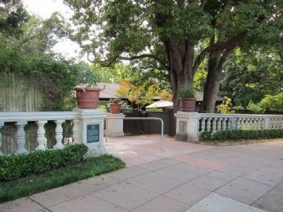
2. Northbrae Public Improvements Marker - Wide View
The marker is visible here, mounted on a column at the end of a balustrade by Fountain Path. The balustrades, forming the outer edge of the Circle, merited a preservation award from the Berkeley Archictectural Heritage Association in 1994.
Photographed By Andrew Ruppenstein, October 3, 2010
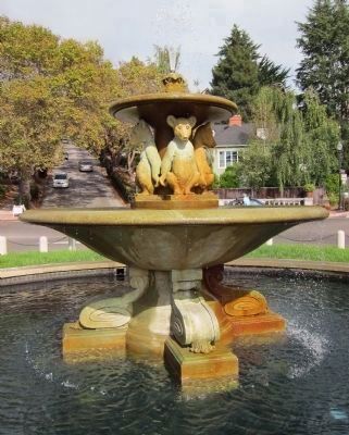
4. The Circle Fountain - 1911/1996
The original fountain, designed by John Galen Howard and featuring four grizzly cubs sculpted by Arthur Putnam, was Berkeley's first public work of art. The fountain was destroyed in 1958 by a runaway truck coming down Marin Avenue. The new fountain was replicated and installed in 1996.
Photographed By Andrew Ruppenstein, October 3, 2010
5. The Circle Fountain - Grizzly Cubs
Although the Fountain was replicated using the original drawings, these were unavailable for the bears. Consequently, sculptor Sarita Camille Waite created new bears according the style of Arthur Putnam, the sculptor of the originals.
Photographed By Andrew Ruppenstein, October 3, 2010
6. The Circle
Designed by John Galen Howard in 1907, The Circle (with six streets feeding into it) is the focal point of Berkeley's Northbrae neighborhood. The Circle and Fountain would have been part of the entryway to the grounds of the new state capitol, had California's voters not rejected the 1908 ballot measure to move the capital from Sacramento to Berkeley.
Credits. This page was last revised on February 7, 2023. It was originally submitted on October 7, 2010, by Andrew Ruppenstein of Lamorinda, California. This page has been viewed 1,101 times since then and 31 times this year. Photos: 1, 2, 3, 4, 5, 6. submitted on October 7, 2010, by Andrew Ruppenstein of Lamorinda, California. • Syd Whittle was the editor who published this page.
