Old Montreal in Montréal in Communauté-Urbaine-de-Montréal, Québec — Central Canada (French-Canadian)
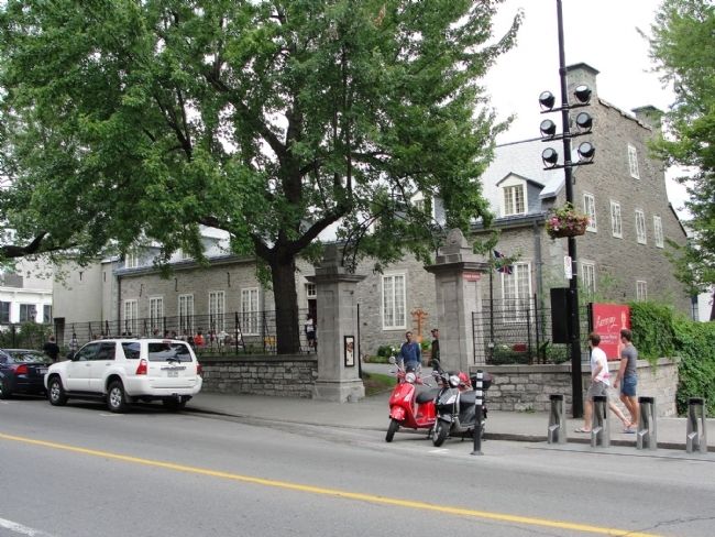
Le Château Ramezay / Château Ramezay
[Royal Coat of Arms of Canada]
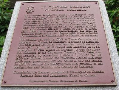
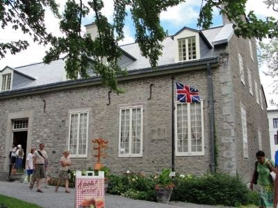
Le gouverneur de Montréal Claude de Ramezay fit ériger ici en 1705, par Pierre Couturier, un édifice pour lui servir de demeure. La Compagnie des Indes occidentales, qui le posséda de 1745 à 1763, le fit rebâtir et élargir en 1756 selon les plans de Paul Tessier dit Lavigne. Les gouverneurs généraux résidèrent au Château de 1773 à 1844, les envahisseurs américains s’y logèrent en 1775-1776, et le Conseil exécutif y siégea en 1839. Il abrita après 1849, des bureaux du gouvernement, des cours de justice, des écoles et facultés. Depuis 1895, il loge la Société d’Archéologie et de Numismatique de Montréal et son musée.
The Château was built in 1705 by Pierre Courier, as a residence for Claude de Ramezay, Governor of Montreal. The Compagnie des Indes occidentales, which owned it from 1745-1763, had it rebuilt and enlarged in 1756 after plans by Paul Tessier dit Lavigne. It was the Montreal residence of the Governors General, 1773-1884, and was occupied by American invaders in 1775-76. In 1839 the Château housed the Executive Council and after 1849 other government offices, courts of law and schools. In 1895 it became the headquarters and museum of the Antiquarian and Numismatic Society of Montreal.
Erected by Commission des lieux et monuments historiques du Canada - Historic Sites and Monuments Board of Canada, Gouvernement du Canada - Government of Canada.
Topics. This historical marker is listed in these topic lists: Colonial Era • Government & Politics • War, US Revolutionary. A significant historical year for this entry is 1705.
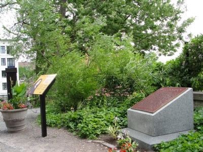
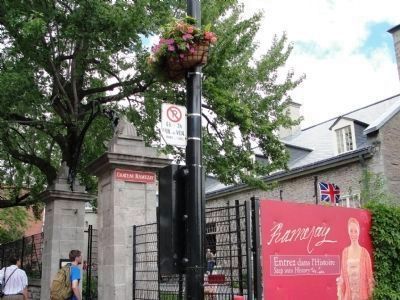
Location. 45° 30.505′ N, 73° 33.226′ W. Marker is in Montréal, Québec, in Communauté-Urbaine-de-Montréal. It is in Old Montreal. Marker is on Place Jacques Cartier east of Rue Notre-Dame, Est. Marker is near the entrance to the Château Ramezay Museum. Touch for map. Marker is at or near this postal address: 280 Rue Notre-Dame, Est, Montréal QC H2Y 1C5, Canada. Touch for directions.
Other nearby markers. At least 8 other markers are within walking distance of this marker. The Nelson Column, Montreal (within shouting distance of this marker); Visitors Center (within shouting distance of this marker); Château de Vaudreuil (about 120 meters away, measured in a direct line); Le Marché Bonsecours / Bonsecours Market (about 150 meters away); Joseph Papineau (about 210 meters away); Cartier Residences (approx. 0.3 kilometers away); Saint-Laurent Boulevard (approx. 0.3 kilometers away); Antoine Laumet de La Mothe, sieur de Cadillac (approx. 0.4 kilometers away). Touch for a list and map of all markers in Montréal.
Also see . . .
1. American Capture of Montreal, 1775. (Submitted on July 31, 2010, by Richard E. Miller of Oxon Hill, Maryland.)
2. Château De Ramezay / India House National Historic Site of Canada. Château De Ramezay / India House was designated as a national historical site of Canada in 1949, because:
- it was built in 1705 by the Governor of Montréal, Claude de Ramezay;
- it contributed importantly to the political and commercial life of New France and of Lower Canada for more than two centuries;
- it was owned by the Compagnie des Indes occidentales from 1745 to 1763;
- it served as the official residence of the Governors-in-Chief of British North America from 1773 to 1844, except for the period between 1775 and 1776 when the site was occupied by American invaders. (Submitted on April 16, 2014, by PaulwC3 of Northern, Virginia.)
Additional keywords. New France; French Canada.
Credits. This page was last revised on February 9, 2023. It was originally submitted on July 31, 2010, by Richard E. Miller of Oxon Hill, Maryland. This page has been viewed 1,197 times since then and 13 times this year. Last updated on October 14, 2010, by Kevin Craft of Bedford, Quebec. Photos: 1, 2, 3, 4, 5. submitted on July 31, 2010, by Richard E. Miller of Oxon Hill, Maryland. • Kevin W. was the editor who published this page.
