Mechanicsville in Hanover County, Virginia — The American South (Mid-Atlantic)
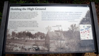
Holding the High Ground
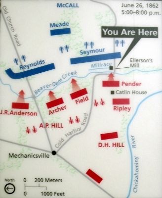
Despite the decisive victory here, army commander George B. McClellan decided to withdraw this exposed portion of his force on the night of June 26. Stonewall Jackson’s Confederates stood poised to threaten the rear of this Beaver Dam Creek position. The first phase of the Confederate plan to drive the Union army away from Richmond by manueuver had succeeded, but only after a battlefield defeat.
“We were deployed at intervals of eight or ten paces, along the [mill]race….A brigade of rebels in close column charged madly down the opposite hillside….Rushing unhesitatingly across the narrow valley that intervened…they were about to ascend our hill, when one of our regiments…which lay concealed in a position near the base, arose and poured such a murderous volley into the rebel ranks that they broke and fled in dismay.”
A. F. Hill, 8th Pennsylvania Reserves
Erected 2010 by Richmond National Battlefield Park.
Topics. This historical marker is listed in this topic list: War, US Civil. A significant historical date for this entry is June 26, 1952.
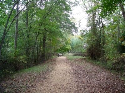
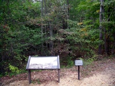
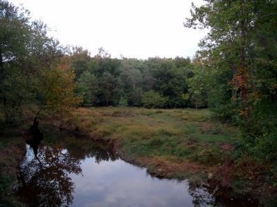
Location. 37° 35.712′ N, 77° 21.487′ W. Marker is in Mechanicsville, Virginia, in Hanover County. Marker can be reached from Cold Harbor Road (Virginia Route 156). This marker is located in the Beaver Dam Creek unit of the Richmond National Battlefield Park. Touch for map. Marker is at or near this postal address: 7423 Cold Harbor Road, Mechanicsville VA 23111, United States of America. Touch for directions.
Other nearby markers. At least 8 other markers are within walking distance of this marker. Site of Ellerson’s Mill (here, next to this marker); Historic Cold Harbor Road (within shouting distance of this marker); Lee’s First Strike (about 300 feet away, measured in a direct line); Beaver Dam Creek (about 300 feet away); a different marker also named Beaver Dam Creek (about 600 feet away); Ellerson's Mill (about 700 feet away); Seven Days Battles (approx. ¼ mile away); a different marker also named Seven Days Battles (approx. 0.7 miles away). Touch for a list and map of all markers in Mechanicsville.
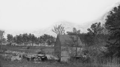
More about this marker. The backgound photograph of Ellerson's Mill carries the caption, "Dr. John Ellerson’s gristmill served the community before and after the war. It stood as the most noticeable landmark along the Union line. Although the building is gone, the millrace (visible to the left of the mill) still exists in the woods."
Related marker. Click here for another marker that is related to this marker. Old Marker At This Location titled "The Pennsylvanians Stand Firm".
Also see . . . The Battle of Beaver Dam Creek, June 26, 1862. Richmond National Battlefield Park. (Submitted on October 18, 2010, by Bernard Fisher of Richmond, Virginia.)
Credits. This page was last revised on November 5, 2021. It was originally submitted on October 18, 2010, by Bernard Fisher of Richmond, Virginia. This page has been viewed 1,077 times since then and 27 times this year. Photos: 1, 2, 3. submitted on October 18, 2010, by Bernard Fisher of Richmond, Virginia. 4. submitted on October 19, 2010, by Bernard Fisher of Richmond, Virginia. 5, 6. submitted on October 18, 2010, by Bernard Fisher of Richmond, Virginia.
