Dahlonega in Lumpkin County, Georgia — The American South (South Atlantic)
The Public Square
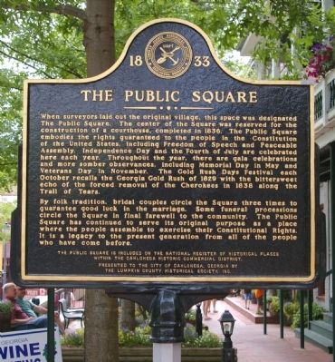
By folk tradition, bridal couples circle the Square three times to guarantee good luck in the marriage. Some funeral processions circle the Square in final farewell to the community. The Public Square had continued to serve its original purpose as a place where the people assemble to exercise their Constitutional Rights. It is a legacy to the present generation from all of the people who have come before.
The Public Square is included in the National Register of Historic Places within the Dahlonega Historic Commercial District.
Present to the city of Dahlonega, Georgia by the Lumpkin County Historical Society, Inc.
Erected by Lumpkin County Historical Society, Inc.
Topics. This historical marker is listed in these topic lists: Industry & Commerce • Native Americans • Settlements & Settlers. A significant historical year for this entry is 1836.
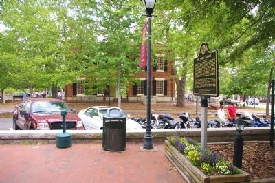
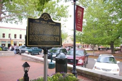
Location. 34° 31.975′ N, 83° 59.11′ W. Marker is in Dahlonega, Georgia, in Lumpkin County. Marker is on Public Square North (Old U.S. 19) 0 miles west of North Park Street. The marker stands on the sidewalk on the Public Square, opposite the Old Courthouse. Touch for map. Marker is in this post office area: Dahlonega GA 30533, United States of America. Touch for directions.
Other nearby markers. At least 8 other markers are within walking distance of this marker. Dahlonega Stories (within shouting distance of this marker); Hall's Block (within shouting distance of this marker); Lumpkin County Historic Courthouse (within shouting distance of this marker); Lumpkin County Veterans Memorial (within shouting distance of this marker); a different marker also named Dahlonega Stories (within shouting distance of this marker); a different marker also named Dahlonega Stories (within shouting distance of this marker); Lumpkin Court House (within shouting distance of this marker); a different marker also named Dahlonega Stories (about 300 feet away, measured in a direct line). Touch for a list and map of all markers in Dahlonega.
Additional keywords.
forced relocation

Photographed By David Seibert, May 2, 2010
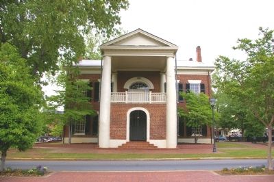
4. The Old Lumpkin County Courthouse
The original Lumpkin County Courthouse, which sits in the middle of the Public Square, was built in 1836. It cost $6850, which was paid in gold bullion. It was replaced by a new courthouse in 1965, and is now the Gold Museum.
Credits. This page was last revised on January 31, 2020. It was originally submitted on July 30, 2010, by David Seibert of Sandy Springs, Georgia. This page has been viewed 996 times since then and 22 times this year. Last updated on October 30, 2010, by R. Zebley of Rapid City, South Dakota. Photos: 1, 2, 3, 4. submitted on July 30, 2010, by David Seibert of Sandy Springs, Georgia. • Craig Swain was the editor who published this page.


