Greenwich in Fairfield County, Connecticut — The American Northeast (New England)
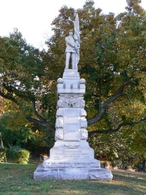
Soldiers' and Sailors' Monument
Erected 1890.
Topics. This historical marker and monument is listed in this topic list: War, US Civil.
Location. 41° 2.136′ N, 73° 37.337′ W. Marker is in Greenwich, Connecticut, in Fairfield County. Marker is at the intersection of Maple Avenue and East Putnam Avenue (U.S. 1), on the right when traveling north on Maple Avenue. Touch for map. Marker is in this post office area: Greenwich CT 06830, United States of America. Touch for directions.
Other nearby markers. At least 8 other markers are within 2 miles of this marker, measured as the crow flies. Founders and Proprietors Monument (within shouting distance of this marker); George Washington Paused Here (within shouting distance of this marker); Putnam Cottage (approx. 0.2 miles away); Putnam's Escape (approx. 0.3 miles away); Greenwich Veterans Monument (approx. ¾ mile away); Raynal C. Bolling (approx. 0.8 miles away); Greenwich World War I Memorial (approx. 0.8 miles away); Second Oldest Cemetery in Greenwich (approx. 1.2 miles away). Touch for a list and map of all markers in Greenwich.
More about this monument. The monument's south face also lists the battles of Kingston (Ga.), Morris Island (S.C.) and Antietam. The east face lists Appomattox, Gettysburg, Vicksburg and Port Hudson (La.). The north side lists Drury’s Bluff, Petersburg and Deep Run (all in Virginia), and the west side lists New-Berne (N.C.) , Darbytown Road (Va.), Fort Fisher (N.C.) and Fort Gregg (S.C.).
Credits. This page was last revised on June 16, 2016. It was originally submitted on November 1, 2010, by Dave Pelland of Milford, Connecticut. This page has been viewed 1,084 times since then and 24 times this year. Photo 1. submitted on November 1, 2010, by Dave Pelland of Milford, Connecticut. • Craig Swain was the editor who published this page.
