Near Fredericksburg in Spotsylvania County, Virginia — The American South (Mid-Atlantic)
The Battle of Fredericksburg
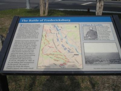
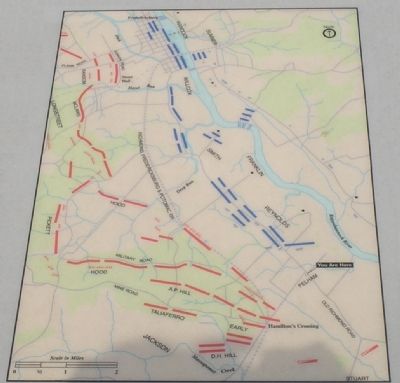
Franklin and Sumner had the same objective: drive the Confederate army from its stronghold on the heights west of the river. Franklin would attack the right end of the Confederate line at Prospect Hill, one-half mile to your left-front, while Sumner attacked the left end of the enemy line at Marye’s Heights, in rear of Fredericksburg. Franklin deployed his troops one-quarter mile ahead of you. At 10 a.m., December 13, 1862, as he was making final arrangements for the assault, the sound of cannon fire broke the silence. Franklin himself was under attack!
Erected 2007 by The Delaware Corporation.
Topics. This historical marker is listed in this topic list: War, US Civil. A significant historical date for this entry is December 13, 1862.
Location. 38° 15.157′ N, 77° 25.579′ W. Marker is near Fredericksburg, Virginia, in Spotsylvania County. Marker is at the intersection of Benchmark Road (County Route 608) and Tidewater Trail ( Virginia Route 2), on the right when traveling north on Benchmark Road. Touch for map. Marker is in this post office area: Fredericksburg VA 22408, United States of America. Touch for directions.
Other nearby markers. At least 8 other markers are within walking distance of this marker. The Gallant Pelham (here, next to this marker); Stuart and Pelham (a few steps from this marker); a different marker also named The Gallant Pelham (a few steps from this marker); Fort Hood (a few steps from this marker); Fredericksburg Campaign (approx. 0.6 miles away); Dead Horse Hill (approx. 0.6 miles away); a different marker also named Fredericksburg Campaign (approx. 0.6 miles away); Jackson Holds Prospect Hill (approx. 0.6 miles away). Touch for a list and map of all markers in Fredericksburg.
More about this marker. A map showing unit locations during the battle dominates the center of the marker. On the upper right is a portrait of Gen. Franklin captioned, "William B. Franklin - A staff officer who saw Franklin during the war described him as “an easy, unpretending soldier, strong and manly.” At Fredericksburg he commanded the left wing of the Union army." On the lower right is "A view of the battlefield as it appeared in 1893."
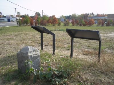
Marker originally faced Tidewater Trail. It was moved about 50 ft south, now facing Benchmark Rd.
Credits. This page was last revised on August 6, 2023. It was originally submitted on November 29, 2007, by Bill Coughlin of Woodland Park, New Jersey. This page has been viewed 1,650 times since then and 29 times this year. Photos: 1, 2, 3. submitted on November 29, 2007, by Bill Coughlin of Woodland Park, New Jersey. • Craig Swain was the editor who published this page.


