Near Shiloh in Hardin County, Tennessee — The American South (East South Central)
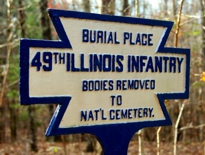
49th Illinois Infantry
Burial Place
49th Illinois Infantry
Bodies Removed
to
Nat'l Cemetery
Erected by Shiloh National Military Park Commission. (Marker Number BG12.)
Topics. This historical marker is listed in this topic list: War, US Civil.
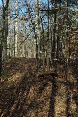
Location. 35° 7.912′ N, 88° 20.85′ W. Marker is near Shiloh, Tennessee, in Hardin County. Marker can be reached from Hamburg-Purdy Road, 0.4 miles east of Sherman Road, on the right when traveling east. 300 yards southwest of road on trail in woods, in Shiloh National Military Park. Trail begins near marker 297, 24th Kentucky Infantry, but is not easily visible from road, and parts are overgrown. Touch for map. Marker is in this post office area: Shiloh TN 38376, United States of America. Touch for directions.
Other nearby markers. At least 8 other markers are within walking distance of this marker. Stewart's Brigade (about 400 feet away, measured in a direct line); 2nd and 3rd Battalions, 4th Illinois Cavalry (about 400 feet away); 12th Tennessee Infantry (about 500 feet away); 77th Pennsylvania Infantry (about 600 feet away); Wood's Brigade (about 600 feet away); Camp of 43rd Illinois Infantry (about 700 feet away); 24th Kentucky Infantry (about 800 feet away); 57th Indiana Infantry (about 800 feet away). Touch for a list and map of all markers in Shiloh.
Credits. This page was last revised on September 22, 2020. It was originally submitted on December 14, 2010, by Allen Gathman of Pocahontas, Missouri. This page has been viewed 599 times since then and 13 times this year. Photos: 1, 2. submitted on December 14, 2010, by Allen Gathman of Pocahontas, Missouri. • Craig Swain was the editor who published this page.

