North Charleston in Charleston County, South Carolina — The American South (South Atlantic)
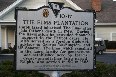
The Elms Plantation
Erected 1995 by The Elms of Charleston and Jacob Van der Ver Chapter, S.C. State Society of the National Society Colonial Dames XVII Century. (Marker Number 10-17.)
Topics and series. This historical marker is listed in these topic lists: Colonial Era • Notable Places. In addition, it is included in the The Colonial Dames XVII Century, National Society series list. A significant historical year for this entry is 1749.
Location. 32° 59.005′ N, 80° 3.604′ W. Marker is in North Charleston, South Carolina, in Charleston County. Marker is on Elms Plantation Blvd.. The marker is location at the end of Elms Plantation Blvd. Touch for map. Marker is in this post office area: Charleston SC 29406, United States of America. Touch for directions.
Other nearby markers. At least 8 other markers are within 2 miles of this marker, measured as the crow flies. The Elms (approx. 0.8 miles away); Broom Hall Plantation (approx. 1.4 miles away); The Oaks (approx. 1.4 miles away); Goose Creek / City of Goose Creek (approx. 1.6 miles away); Goose Creek Bridge (approx. 1.6 miles away); Goose Creek Church (approx. 1.6 miles away); Otranto Plantation (approx. 1.7 miles away); St. James, Goose Creek (approx. 1.7 miles away).
Credits. This page was last revised on November 2, 2020. It was originally submitted on December 16, 2010, by David Bullard of Seneca, South Carolina. This page has been viewed 1,493 times since then and 106 times this year. Photo 1. submitted on December 16, 2010, by David Bullard of Seneca, South Carolina. • Bill Pfingsten was the editor who published this page.
