Lookout Valley in Tiftonia in Hamilton County, Tennessee — The American South (East South Central)
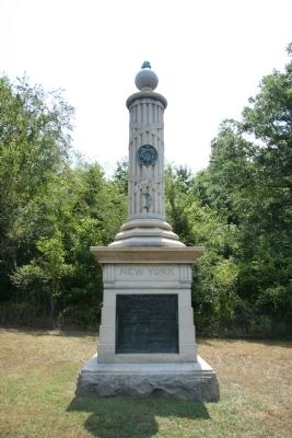
New York Troops - 11th Corps
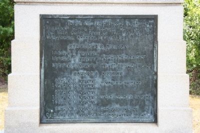
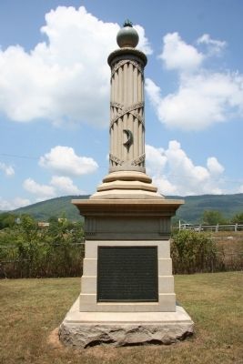
To the New York Troops in Howard's Eleventh Corps of Hooker's Command, 11th and 12th Corps, Army of the Potomac, at Wauhatchie, October 28 - 29, 1863.
134th N.Y. Infantry, Buschbeck's Brigade
154th N.Y. Infantry, Buschbeck's Brigade
136th N.Y. Infantry, Orland Smith's Brigade
Schurz's Division.
45th N.Y. Infantry, Tyndale's Brigade
143rd N.Y. Infantry, Tyndale's Brigade
58th N.Y. Infantry, Krzyzanowski's Brigade
119th N.Y. Infantry, Krzyzanowski's Brigade
141st N.Y. Infantry, Krzyzanowski's Brigade
68th N.Y. Infantry, Hecker's Brigade
Co. A 8th N.Y. Infantry, Headquarters Guard
[Right Side of Monument]:
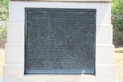
Soon after firing was heard in the direction of Wauhatchie, Gen. Schurz was ordered to push his leading brigade to the relief of Gen. Geary.
Tyndale's Brigade was in the advance. Its left, while passing Smith's Hill, was fired upon by the enemy concealed in the woods; the brigade proceeded to the hill on the right of this monument (known as Tyndale's Hill) from which the enemy was speedily driven. Krzyzanowski's Brigade was then placed in the gap between Smith's and Tyndale's Hills and Gen. Schurz, instructed by Gen. Hooker in person, sent Hecker's Brigade to effect a junction with Geary's Division, which was accomplished about 5 A.M. The operations of Howard's Corps and those of Geary's Division, 12th Corps, dislodged the enemy from every position this side of Lookout Creek, and, in conunction with the troops at Brown's Ferry under Gen. W.F. Smith, reopened the Union lines of communication to Chattanooga.
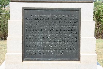
[Reverse Side of Monument]:
On the afternoon of October 28, 1863, two divisions of the 11th Corps, meeting with slight opposition, moved down this valley toward Brown's Ferry, where unction was effected with Hazen's and Turchin's Brigades and the 18th Ohio, all under Gen. W.F. Smith. After encamping, strong outposts were thrown out. A detachment of 150 men, from the 141st New York, under command of ma. C.W. Clauharty, advancing beyond these foothills about 500 yards east from where this monument stands, discovered and skirmished with the enemy, shortly before midnight, moving to attack the Union forces in the valley.
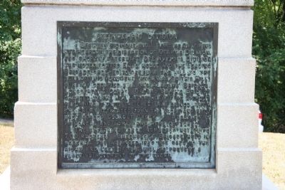
[Left Side of Monument]:
Between midnight and 1 A.M. heavy fighting was heard in the direction of Geary's Division, and shortly afterward Steinwehr's Division was moved toward Ellis' house and the leading Brigade ordered to capture the hill to the left of this monument (known
as Smith's Hill) already occupied by Law's Alabama Brigade, Longstreet's Corps. Orland Smith's Brigade
charged up the hill under heavy fire without returning it until the crest was gained, when the enemy retreated down the slope and fell back across Lookout Creek. About fifty prisoners and some arms were captured.
The attacking force numbered not quite 700 muskets. Buschbeck's Brigade held in reserve, was advanced into the gaps to the right and left of the hill to prevent a flanking movement of the enemy.
Erected 1899 by State of New York. (Marker Number MT240-44.)
Topics. This historical marker is listed in this topic list: War, US Civil. A significant historical year for this entry is 1863.
Location. 35° 1.673′ N, 85° 21.6′ W. Marker is in Tiftonia, Tennessee, in Hamilton County. It is in Lookout Valley. Marker is on Parker Lane near Brown's Ferry Road, on the left when traveling north. According to the location information provided by the National Park Service, this, “Monument (is) located at Wauhatchie Site 1 on Parker Lane off Brown's Ferry Road in Lookout Valley.". Touch for map. Marker is in this post office area: Chattanooga TN 37419, United States of America. Touch for directions.
Other nearby markers. At least 8 other markers are within 2 miles of this marker, measured as the crow flies. Wiedrich's New York Battery (approx. ¼ mile away); Lookout Creek (approx. 0.6 miles away); Brown's Ferry
(approx. 0.6 miles away); Battle of Wauhatchie (approx. 0.6 miles away); Battle of Lookout Mountain (approx. 0.6 miles away); Wauhatchie (approx. one mile away); John Brown's Ferry Tavern, 1803 (approx. 1.2 miles away); Heavy Slashings of Timber (approx. 1.3 miles away). Touch for a list and map of all markers in Tiftonia.
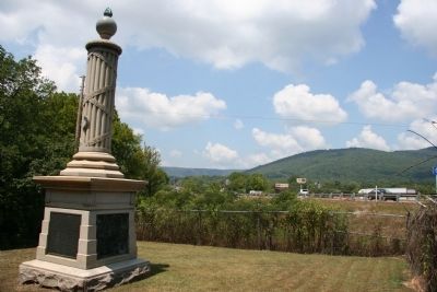
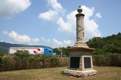
More about this marker. This historical marker was difficult to locate, seemingly located out in the middle of nowhere. It can be seen from the eastbound lane of Interstate 24, being situated just beyond the eastbound on-ramp of Brown's Ferry Road. To reach the historical marker one must first locate the street, Parker Lane, which is situated at the first street intersection on Brown's Ferry Road just south of Interstate 24.
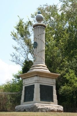
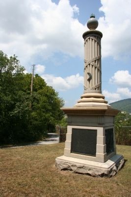
According to the description information provided by the National Park Service, the monument is, “7'2" x 7'2" x 22'9" high, the monument consists of a fasces-type column on a large rectangular pedestal. Single-piece, rock-faced base; a bronze inscription plaque on each side of pedestal; ball finial atop column."
From Brown's Ferry Road, turn east onto Parker
Lane. After driving on Parker Lane for a little over a block the pavement gives way to a rough gravel roadway and bends northward. Just before the roadway reaches Interstate 24 it bends sharply east and then south. It is on the north side of this bend that one can see this historical marker.
Related markers. Click here for a list of markers that are related to this marker. To better understand the relationship, study each marker in the order shown.
Credits. This page was last revised on February 7, 2023. It was originally submitted on December 31, 2010, by Dale K. Benington of Toledo, Ohio. This page has been viewed 1,686 times since then and 54 times this year. Photos: 1, 2, 3, 4, 5, 6, 7, 8, 9, 10. submitted on January 1, 2011, by Dale K. Benington of Toledo, Ohio.
