Keauhou in Hawaii County, Hawaii — Hawaiian Island Archipelago (Pacific Ocean)
Keauhou - Kahalu'u Heritage Corridor
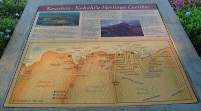
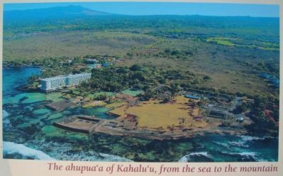
Moku (island districts) were traditionally subdivided into smaller land wedges called ahupua'a. Generally, these ahupua'a extend from the mountain to the sea and contain all the resources needed for sustainable living. Mauka (upland) field systems were cultivated for crops and the makai (seaward) focus was on ocean resources such as fishing and salt preparation. Natural resources were of paramount importance and every person within the community shouldered the responsibility of malama 'aina (caring for the land).
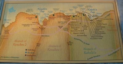
Three neighboring ahupua'a, holding some of Hawai'i's most culturally significant sites, comprise the Keauhou - Kahalu'u Heritage Corridor: Keauhou I, Keauhau II and Kahalu'u. These lands hold special significance for Hawaiian civilization where ancestral inheritance has been passed down for centuries in the ancient place names, historical sites and cultural practices of today.
The area's natural upslope topography drew evening rains, making the land more livable by providing fresh water. Early Hawaiians welcomed the comfortable living conditions and densely populated Kahalu'u, while the more dramatic lands of Keauhou I and II were less hospitable. The ahupua'a of Kahalu'u, which takes its name from a chiefess of high rank, served as the occasional residence of several Hawaiian kings.
Easy shoreline access allowed for fishing and travel by canoe. Sweeping coastal views were prized for their strategic significance in combat and served as an early warning system during threats of invasion. From this vantage point, you can see for miles.
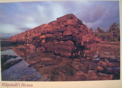
Although numerous historical sites have vanished over time, it is important to cite traditional place names as a reminder of how precious the past is to humanity. The map below illustrates these place names, visible historical sites and modern landmarks. Reminder: Do not disturb any historical site and respect the sacredness of the 'aina.
Visit the Keauhou Kahalu'u Heritage Center at the Keauhou Shopping Center to learn more about the area and the enormous restoration projects underway.
Topics. This historical marker is listed in these topic lists: Anthropology & Archaeology • Asian Americans • Settlements & Settlers.
Location. 19° 34.142′ N, 155° 57.748′ W. Marker is in Keauhou, Hawaii, in Hawaii County. Marker is at the intersection of Alii Drive and King Kamehameha III Road, on the left when traveling north on Alii Drive. Touch for map. Marker is in this post office area: Keauhou HI 96739, United States of America. Touch for directions.
Other nearby markers. At least 8 other markers are within walking distance of this marker. Inikiwai Ku'ula Heiau (approx. 0.3 miles away); Lonoikamakahiki Residence
(approx. 0.4 miles away); Hale Mua (approx. 0.4 miles away); Kauikeaouli, Kamehameha III (approx. half a mile away); Birthplace of Kauikeaouli (approx. half a mile away); Keauhou Bay (approx. half a mile away); Kauikeaouli and Nāhi'ena'ena (approx. half a mile away); The Kamehameha Dynasty (approx. half a mile away). Touch for a list and map of all markers in Keauhou.
Additional keywords. Native Hawaiians, Pacific Islanders
Credits. This page was last revised on August 23, 2020. It was originally submitted on January 3, 2011, by William J. Toman of Green Lake, Wisconsin. This page has been viewed 1,424 times since then and 90 times this year. Photos: 1. submitted on January 3, 2011, by William J. Toman of Green Lake, Wisconsin. 2, 3, 4, 5. submitted on January 6, 2011, by William J. Toman of Green Lake, Wisconsin. • Syd Whittle was the editor who published this page.
