Independence in Jackson County, Missouri — The American Midwest (Upper Plains)
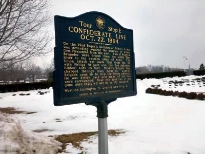
Confederate Line
Oct. 22, 1864
— Battle of Westport —
Tour Stop E
On the 22nd Fagan’s Division of Price’s Army was defending against the advance of Union Gen. Pleasonton from the east. Two of Fagan’s Brigades were driven from the Little Blue River to the eastern edge of town. The Union attack was made first from the NE with Philips’ Brigade and the 2nd Arkansas (Union) both on foot. McNeil’s Brigade then charged through town mounted. Cabell’s Brigade came up to stop the Union advance. He was driven back and many of his men were surrounded. Near this spot two of his guns were captured and he barely escaped.
West on Lexington to Crysler and Stop F
Erected by City of Independence and Howard N. Monett Memorial Civil War Round Table. (Marker Number E.)
Topics. This historical marker is listed in this topic list: War, US Civil.
Location. 39° 5.481′ N, 94° 25.636′ W. Marker is in Independence, Missouri, in Jackson County. Marker is at the intersection of South River Boulevard and West Lexington Avenue, on the right when traveling north on South River Boulevard. The marker stands along the west side of Independence Temple of the Community of Christ. Touch for map. Marker is in this post office area: Independence MO 64050, United States of America. Touch for directions.
Other nearby markers. At least 8 other markers are within walking distance of this marker . Temple Site (within shouting distance of this marker); The Stone Church (about 300 feet away, measured in a direct line); Temple Lot (about 400 feet away); Flournoy Home (about 500 feet away); F.M. Smith Study (about 500 feet away); Flournoy House (about 500 feet away); Joseph T. Noland House (approx. ¼ mile away); Gingko Tree (approx. ¼ mile away). Touch for a list and map of all markers in Independence.
Also see . . . Second Battle of Independence. Wikipedia entry (Submitted on February 9, 2011, by Jamie Abel of Westerville, Ohio.)
Credits. This page was last revised on May 2, 2022. It was originally submitted on February 9, 2011, by Jamie Abel of Westerville, Ohio. This page has been viewed 1,080 times since then and 35 times this year. Photos: 1, 2. submitted on February 9, 2011, by Jamie Abel of Westerville, Ohio. • Craig Swain was the editor who published this page.

