Mechanicsville in Hanover County, Virginia — The American South (Mid-Atlantic)
Lee’s First Strike
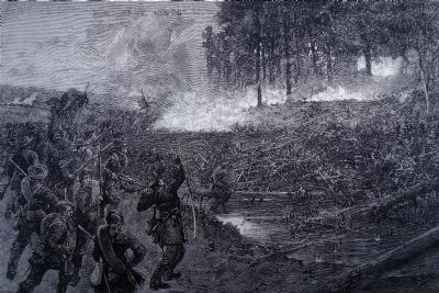
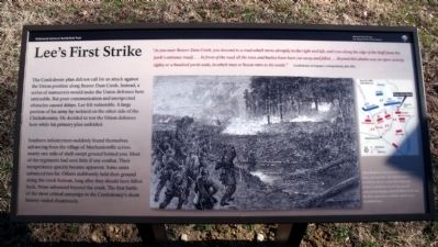
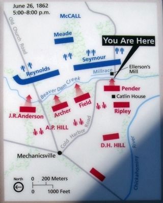
Southern infantrymen suddenly found themselves advancing from the village of Mechanicsville across nearly one mile of shell-swept ground behind you. Most of the regiments had seen little if any combat. Their inexperience quickly became apparent. Some units advanced too far. Others stubbornly held their ground along the creek bottom, long after they should have fallen back. None advanced beyond the creek. The first battle of the most critical campaign in the Confederacy’s short history ended disastrously.
“As you near Beaver Dam, you descend to a road which turns abruptly to the right and left, and runs along the edge of the bluff [now the park’s entrance road]….In front of the road all the trees and bushes have been cut away and felled….Beyond this abattis was an open swamp, eighty or a hundred yards wide, in which man or beasts mire to the waist.” Confederate newspaper correspondent, July 1862
Erected 2011 by Richmond National Battlefield Park.
Topics. This historical marker is listed in this topic list: War, US Civil. A significant historical year for this entry is 1862.
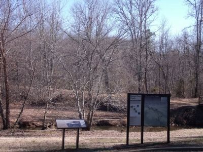
Location. 37° 35.739′ N, 77° 21.545′ W. Marker is in Mechanicsville, Virginia, in Hanover County. Marker can be reached from Cold Harbor Road (Virginia Route 156). This marker is located in the Beaver Dam Creek unit of Richmond National Battlefield Park. Touch for map. Marker is at or near this postal address: 7423 Cold Harbor Road, Mechanicsville VA 23111, United States of America. Touch for directions.
Other nearby markers. At least 8 other markers are within walking distance of this marker. Beaver Dam Creek (a few steps from this marker); Historic Cold Harbor Road (within shouting distance of this marker); a different marker also named Beaver Dam Creek (about 300 feet away, measured in a direct line); Holding the High Ground (about 300 feet away); Site of Ellerson’s Mill (about 300 feet away); Ellerson's Mill (approx. 0.2 miles away); Seven Days Battles (approx. 0.2 miles away); a different marker also named Seven Days Battles (approx. 0.7 miles away). Touch for a list and map of all markers in Mechanicsville.
Also see . . . The Battle of Beaver Dam Creek, June 26, 1862. Richmond National Battlefield Park (Submitted on February 12, 2011, by Bernard Fisher of Richmond, Virginia.)

Photographed By Allen Redwood
3. Combat at Beaver Dam Creek
Allen Redwood served in the Confederate army, survived the war, and became a prominent sketch artist. His depiction of the Confederate attack has special authenticity because Beaver Dam Creek was his first experience in battle, and he was wounded here.
Credits. This page was last revised on June 16, 2016. It was originally submitted on February 12, 2011, by Bernard Fisher of Richmond, Virginia. This page has been viewed 1,174 times since then and 31 times this year. Photos: 1, 2, 3, 4, 5. submitted on February 12, 2011, by Bernard Fisher of Richmond, Virginia.


