Jamestown in James City County, Virginia — The American South (Mid-Atlantic)
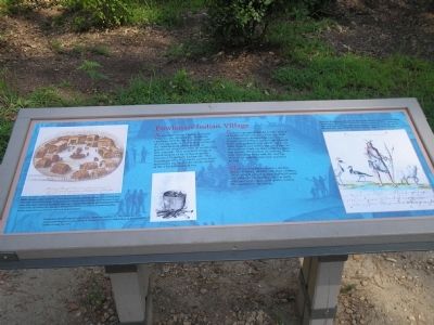
Powhatan Indian Village
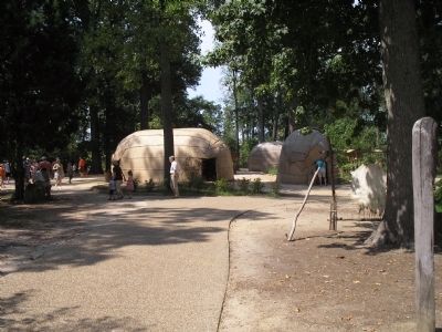
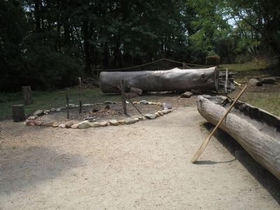
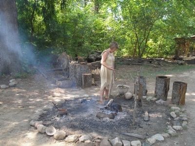
At the time of the English arrival in Virginia, the tribes of the Powhatan chiefdom were living in communities of varying sizes. Larger towns contained the residences of chiefs as well as specialized structures such as storehouses and a temple. This reconstructed village is based on part of an archaeologically excavated Paspahegh Indian site. The Paspahegh tribe had towns upriver from Jamestown on both sides of the mouth of the Chickahominy River.
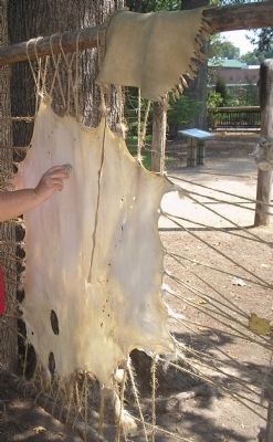
Powhatan people obtained a wide variety of food and raw material from the land and waterways surrounding each town. Women and children worked the adjacent fields and gathered wild plants and roots. Men hunted and fished, but used time in the town to work on their tools, weapons and canoes. Production of clothing from deer and other hides and the making of mats to cover houses were activities as well.
Most households included a nuclear family of father, mother and their children. These people played games and held social and religious ceremonies, such as daily offerings to the gods and spirits, within the confines of the town.
Topics. This historical marker is listed in this topic list: Native Americans.
Location. 37° 13.434′ N, 76° 47.17′ W. Marker is in Jamestown, Virginia, in James City County. Marker can be reached from Jamestown Road (Virginia Route 31), on the left when traveling south. Marker is at the Jamestown Settlement. Touch for map. Marker is in this post office area: Jamestown VA 23081, United States of America. Touch for directions.
Other nearby markers. At least 8 other markers are within walking distance of this marker. At Jamestown Began: (within shouting distance of this marker); James Fort (about 600 feet away, measured in a direct line); Ships (about 700 feet away); Susan Constant (approx. 0.2 miles away); Godspeed (approx. 0.2 miles away); Voyage to Virginia (approx. 0.2 miles away); John Smith Explores the Chesapeake (approx. 0.2 miles away); Jamestown (approx. 0.2 miles away). Touch for a list and map of all markers in Jamestown.
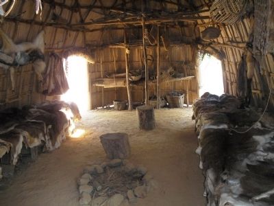
More about this marker. The left of the marker contains a drawing of an Indian village. It has a caption of “Indian houses called ‘yehakins,’ were built by bending young saplings and covering them with mats woven from reeds. Archaeological evidence shows the houses to be more oval in shape than those depicted in English drawings. Low wooden frames for sleeping lined the inside walls. An indoor fire was used for warmth and for cooking in inclement weather. People stored their possessions and food in their houses.”
Below this is a picture of a cooking pot, with the caption “Powhatans planted crops of corn, beans, squash and sunflowers. They dried the foods
and ground them up to use as flour in breads or hominy, or added them to meat in stews, cooked in large clay pots.”
The right of the marker features a picture of a Powhatan Indian. It has a caption of “Powhatan clothing was made from the hides of whitetail deer. Items of decoration included body paint made from roots and berries, tattooing among the women, freshwater pearls, and beads made from shells. Those of highest status in the society also adorned themselves with copper ornaments, made from copper traded into the area.”
Also see . . . Jamestown Settlement. Jamestown-Yorktown Foundation website entry (Submitted on February 13, 2011, by Bill Coughlin of Woodland Park, New Jersey.)
Credits. This page was last revised on January 20, 2023. It was originally submitted on February 13, 2011, by Bill Coughlin of Woodland Park, New Jersey. This page has been viewed 2,550 times since then and 156 times this year. Photos: 1, 2, 3, 4, 5, 6. submitted on February 13, 2011, by Bill Coughlin of Woodland Park, New Jersey.
