Civic Center in Manhattan in New York County, New York — The American Northeast (Mid-Atlantic)
Foley Square Before 1600
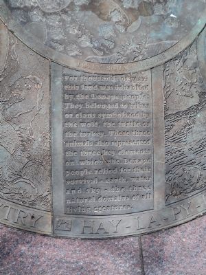
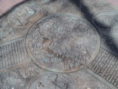
For thousands of years this land was inhabited by the Lenape people. They belonged to tribes or clans symbolized by the wolf, the turtle or the turkey. These three animals also represented the three key elements on which the Lenape people relied for their survival – earth, water and sky – the three natural domains of all living creatures.
[ Marker #2 ]
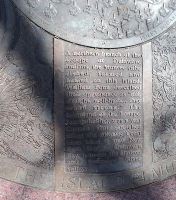
A northern branch of the Lenape or Delaware Indians, the Munsee tribe fished, farmed and hunted on this island. William Penn described their appearance as “tall, straight, well-built . . . they tread strong.” The homeland of the Lenape, Lenapehoking, was a vast domain that stretched along the Atlantic Coast from what is now New York Bay to Delaware Bay, between the Hudson and Delaware valleys.
[ Marker #3 ]
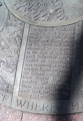
The land on which you presently stand originally formed the edge of the largest body of fresh water on the island now called Manhattan. On rocky bluffs to the west of this large pond, indigenous peoples feasted on oysters that were commonly as large as one foot. Expert navigators, the Lenape carved boats from timber logs by burning and scraping. These ocean-going vessels were used for traveling, fishing and whaling.
The place where the sun is born. • Menesenek • On the island Munsee. • People of the Stony Country. • Hay - La - Py - Ee Chen Quay - Hee - Lass
Topics. This historical marker is listed in this topic list: Native Americans.
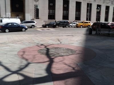
Location. 40° 42.897′ N, 74° 0.122′ W. Marker is in Manhattan, New York, in New York County. It is in Civic Center. Marker is at the intersection of Centre Street and Worth Street, on the right when traveling north on Centre Street. The marker is in the pavement at the southeast corner of the intersection. Touch for map. Marker is in this post office area: New York NY 10007, United States of America. Touch for directions.
Other nearby markers. At least 8 other markers are within walking distance of this marker. Foley Square c. 1880 (within shouting distance of this marker); New York County Court House (within shouting distance of this marker); Thomas Paine Park (within shouting distance of this marker); Abraham De Peyster (within shouting distance of this marker); Foley Square c. 1800 (about 300 feet away, measured in a direct line); Triumph of the Human Spirit (about 300 feet away); Sounding Stones (about 400 feet away); Judge Walter R. Mansfield Memorial (about 500 feet away). Touch for a list and map of all markers in Manhattan.
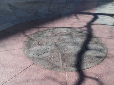
More about this marker. The center of the marker contains a relief of a map depicting how the area appeared prior to 1600. Around this are relief images of a wolf, turtle and turkey.
Credits. This page was last revised on January 31, 2023. It was originally submitted on April 2, 2011, by Bill Coughlin of Woodland Park, New Jersey. This page has been viewed 775 times since then and 30 times this year. Photos: 1, 2, 3, 4, 5, 6. submitted on April 2, 2011, by Bill Coughlin of Woodland Park, New Jersey.
