Locust Grove in Orange County, Virginia — The American South (Mid-Atlantic)
The Mine Run Campaign
The Battle of Payne’s Farm
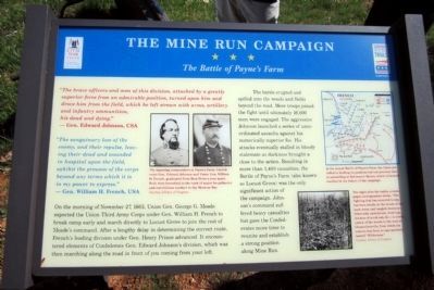
“The sanguinary loss of the enemy, and their repulse, leaving their dead and wounded in hospital upon the field, exhibit the prowess of the corps beyond any terms which it is in my power to express.” — Gen. William H. French, USA
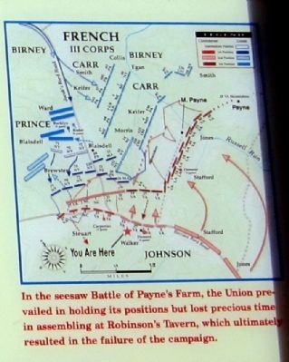
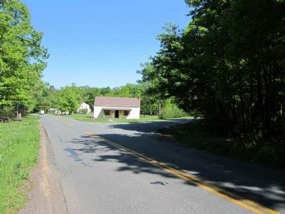
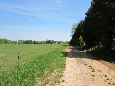
On the morning of November 27, 1863, Union Gen. George G. Meade expected the Union Third Army Corps under Gen. William H. French to break camp early and march directly to Locust Grove to join the rest of Meade’s command. After a lengthy delay in determining the correct route, French’s leading division under Gen. Henry Prince advanced. It encountered elements of Confederate Gen. Edward Johnson’s division, which was then marching along the road in front of you coming from your left.
The battle erupted and spilled into the woods and fields beyond the road. More troops joined the fight until ultimately 16,000 men were engaged. The aggressive Johnson launched a series of uncoordinated assaults against his numerically superior foe. His attacks eventually stalled in bloody stalemate as darkness brought a close to the action. Resulting in more than 1,400 casualties, the Battle of Payne’s Farm (also known as Locust Grove) was the only significant action of the campaign. Johnson’s command suffered heavy casualties but gave the Confederates more time to reunite and establish a strong position along Mine Run.
Erected 2011 by The Civil War Trust and Virginia Civil War Trails.
Topics and series. This historical marker is listed in this topic list: War, US Civil. In addition, it is included in the Virginia Civil War Trails series list. A significant historical date for this entry is November 27, 1878.
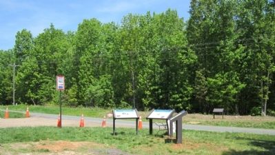
Location. 38° 19.936′ N, 77° 49.708′ W. Marker is in Locust Grove, Virginia, in Orange County. Marker is at the intersection of Zoar Road (Virginia Route 611) and Zoar School Road, on the left when traveling north on Zoar Road. Touch for map. Marker is at or near this postal address: 31334 Zoar Road, Locust Grove VA 22508, United States of America. Touch for directions.
Other nearby markers. At least 8 other markers are within walking distance of this marker. A different marker also named The Mine Run Campaign (here, next to this marker); The Battle of Payne’s Farm (a few steps from this marker); a different marker also named The Battle of Payne’s Farm (approx. 0.2 miles away); a different marker also named The Battle of Payne’s Farm (approx. ¼ mile away); a different marker also named
2. The Mine Run Campaign Marker
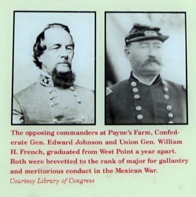
The opposing commanders at Payne’s Farm, Confederate Gen. Edward Johnson and Union Gen. William
H. French, graduated from West Point a year apart. Both were brevetted to the rank of major for gallantry and meritorious conduct In the Mexican War. Courtesy Library of Congress
Also see . . .
1. Mine Run (Payne's Farm). American Battlefield Trust (Submitted on November 11, 2021.)
2. The Mine Run Campaign by James K. Bryant II. Essential Civil War Curriculum, Virginia Center for Civil War Studies at Virginia Tech (Submitted on November 11, 2021.)

1864
4. Battlefield of the "Wilderness"
Views in the woods in the Federal lines on north side of Orange Plank Road. Library of Congress [LC-USZC4-7957]
The night after the battle, a newspaper correspondent wrote “The fighting that has occurred to-day has been wholly in the woods of the most dense and tangled character, filled with underbrush, dead logs, thickets of scrub oak, &c. — a continuation of the woods to the west of Chancellorsville, from which the country has been so appropriate named “Wilderness.”
The night after the battle, a newspaper correspondent wrote “The fighting that has occurred to-day has been wholly in the woods of the most dense and tangled character, filled with underbrush, dead logs, thickets of scrub oak, &c. — a continuation of the woods to the west of Chancellorsville, from which the country has been so appropriate named “Wilderness.”
Credits. This page was last revised on February 23, 2022. It was originally submitted on May 1, 2011, by Bernard Fisher of Richmond, Virginia. This page has been viewed 1,666 times since then and 56 times this year. Photos: 1, 2, 3, 4, 5. submitted on May 1, 2011, by Bernard Fisher of Richmond, Virginia. 6, 7, 8, 9. submitted on May 2, 2011, by Bernard Fisher of Richmond, Virginia.
