Shamong Township in Burlington County, New Jersey — The American Northeast (Mid-Atlantic)
Indian Reservation
Inscription.
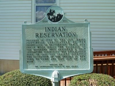
Founded in 1758 by the New Jersey provincial legislature on the Edgepillock or Brotherton tract, now Indian Mills. Under the guidance of the Reverend John Brainerd, a self supporting community was established here. In 1801, the Indians accepted the invitation of the Oneidas in New York to “come and eat out of our dish."
Erected 1958 by The Archeological Society of New Jersey.
Topics. This historical marker is listed in this topic list: Native Americans. A significant historical year for this entry is 1758.
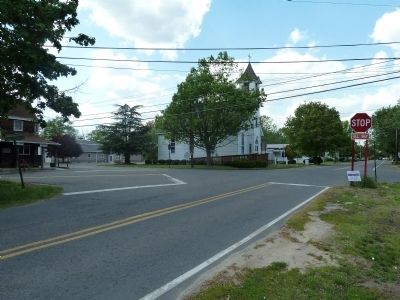
Location. 39° 47.641′ N, 74° 44.664′ W. Marker is near Shamong, New Jersey, in Burlington County. It is in Shamong Township. Marker is at the intersection of Willow Grove Road (County Route 648) and Indian Mills Road (County Route 620), on the right when traveling west on Willow Grove Road. The marker is on the grounds of the Indian Mills Methodist Church just west of a five-point intersection created by the convergence of three roads: Willow Grove(CR648), CR620(Burnt House Rd-Indian Mill Rd), and Forked Neck Road. Touch for map. Marker is in this post office area: Vincentown NJ 08088, United States of America. Touch for directions.
Other nearby markers. At least 8 other markers are within walking distance of this marker. Country Store (within shouting distance of this marker); First Fire Station (about 400 feet away, measured in a direct line); Thompson Home (about 700 feet away); Bedford Mills (approx. 0.2 miles away); Brainerd (approx. 0.2 miles away); Sawmill (approx. 0.2 miles away); Meeting House (approx. 0.2 miles away); Red Men's Hall (approx. 0.7 miles away).
Regarding Indian Reservation. The Indians of the Brotherton-Edgepillock Reservation attempted to persevere here but, after some initial success, began to falter and became demoralized after a fire destroyed the grist mill. Eventually, they accepted an invitation to join the Oneida Indians in New York thus bringing an end to the first and only Native American reservation in New Jersey, and reportedly the first such reservation in America.
Additional keywords. indian resvervations
Credits. This page was last revised on February 7, 2023. It was originally submitted on May 9, 2011, by John Intile of Toms River, New Jersey. This page has been viewed 1,417 times since then and 104 times this year. Last updated on May 9, 2011, by John Intile of Toms River, New Jersey. Photos: 1, 2, 3. submitted on May 9, 2011, by John Intile of Toms River, New Jersey. • Bernard Fisher was the editor who published this page.


