Marker Logo HMdb.org THE HISTORICAL
MARKER DATABASE
“Bite-Size Bits of Local, National, and Global History”
Roberts Ferry in Stanislaus County, California — The American West (Pacific Coastal)
 

Roberts Ferry


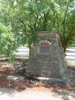
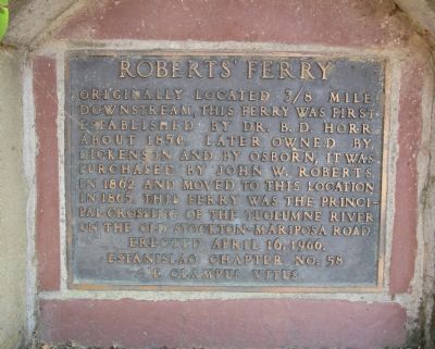
Roberts Ferry Marker image. Click for full size.
Photographed By Syd Whittle, May 19, 2011
1. Roberts Ferry Marker
Inscription. Originally located 3/8 mile downstream, this ferry was first established by Dr. B. D. Horr about 1850. Later owned by Dickenson and by Osborn, it was purchased by John W. Roberts in 1862 and moved to this location in 1865. The ferry was the principal crossing of the Tuolumne River on the old Stockton-Mariposa Road.
 
Erected 1966 by Estanislao Chapter 58, E Clampus Vitus.
 
Topics and series. This historical marker is listed in these topic lists: Industry & CommerceWaterways & Vessels. In addition, it is included in the E Clampus Vitus series list. A significant historical year for this entry is 1850.
 
Location. 37° 38.312′ N, 120° 37.117′ W. Marker is in Roberts Ferry, California, in Stanislaus County. Marker is at the intersection of Yosemite Boulevard (State Highway 132) and Roberts Ferry Road, on the right when traveling east on Yosemite Boulevard. Touch for map. Marker is in this post office area: Waterford CA 95386, United States of America. Touch for directions.
 
Other nearby markers. At least 8 other markers are within 9 miles of this marker, measured as the crow flies. Roberts Ferry History Walk (approx. 0.2 miles away); La Grange Gold Dredge Co. Camp (approx. 7 miles away); Tuolumne Gold Dredge (approx. 8.1 miles away); Historic La Grange (approx. 8.2 miles away);
Paid Advertisement
Click on the ad for more information.
Please report objectionable advertising to the Editor.
Click or scan to see
this page online
LaFayette Historical Lodge #65 (approx. 8.7 miles away); La Grange Saloon (approx. 8.7 miles away); The Old La Grange Schoolhouse (approx. 8.7 miles away); Saint Louis Mission (approx. 8.8 miles away).
 
Roberts Ferry Marker image. Click for full size.
Photographed By Syd Whittle, May 19, 2011
2. Roberts Ferry Marker
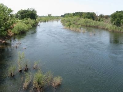
The Tuolumne River at the Site of Roberts Ferry image. Click for full size.
Photographed By Syd Whittle, May 19, 2011
3. The Tuolumne River at the Site of Roberts Ferry
This view of the river is looking west from the Roberts Ferry Covered Bridge.
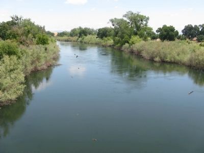
View of the River Looking East image. Click for full size.
Photographed By Syd Whittle, May 19, 2011
4. View of the River Looking East
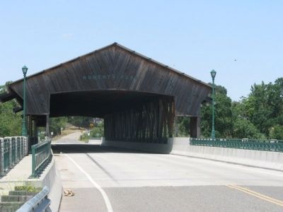
Roberts Ferry Covered Bridge image. Click for full size.
Photographed By Syd Whittle, May 19, 2011
5. Roberts Ferry Covered Bridge
The bridge is located just south of the marker on Roberts Ferry Road.
 
 
Credits. This page was last revised on June 16, 2016. It was originally submitted on May 21, 2011, by Syd Whittle of Mesa, Arizona. This page has been viewed 813 times since then and 27 times this year. Photos:   1, 2, 3, 4, 5. submitted on May 21, 2011, by Syd Whittle of Mesa, Arizona.
Share this page.  
Share on Tumblr
m=42598

CeraNet Cloud Computing sponsors the Historical Marker Database.
This website earns income from purchases you make after using our links to Amazon.com. We appreciate your support.
Paid Advertisement
May. 9, 2024