Bedford in Bedford County, Virginia — The American South (Mid-Atlantic)
Bedford
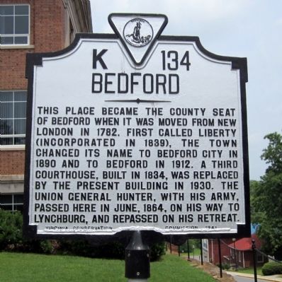
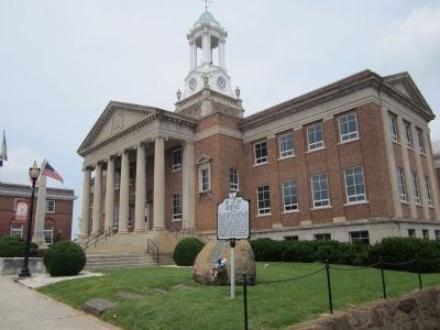
This place became the county seat of Bedford when it was moved from New London in 1782. First called Liberty (incorporated in 1839), the town changed its name to Bedford City in 1890 and to Bedford in 1912. A third courthouse, built in 1834, was replaced by the present building in 1930. The Union General Hunter, with his army, passed here in June, 1864, on his way to Lynchburg, and repassed on his retreat.
Erected 1941 by Virginia Conservation Commission. (Marker Number K-134.)
Topics and series. This historical marker is listed in these topic lists: Settlements & Settlers • War, US Civil. In addition, it is included in the Virginia Department of Historic Resources (DHR) series list. A significant historical month for this entry is June 1864.
Location. 37° 20.051′ N, 79° 31.334′ W. Marker is in Bedford, Virginia, in Bedford County. Marker is at the intersection of East Main Street (Business U.S. 460) and Court Street, on the right when traveling west on East Main Street. Touch for map. Marker is at or near this postal address: 129 E Main St, Bedford VA 24523, United States of America. Touch for directions.
Other nearby markers. At least 8 other markers are within walking distance of this marker. Bedford’s Volunteer Company (here, next to this marker); Bedford County WWII Memorial (within shouting distance of this marker); Bedford County Confederate Monument (within shouting distance of this marker); a different marker also named Bedford (about 500 feet away, measured in a direct line); Peaks of Otter Road (approx. 0.3 miles away); Avenel (approx. 0.3 miles away); Randolph-Macon Academy (approx. 0.6 miles away); Home of John Goode (approx. 0.6 miles away). Touch for a list and map of all markers in Bedford.
Also see . . .
1. City of Bedford, Virginia. City website homepage (Submitted on May 30, 2011.)
2. Hunter's Raid (or the Lynchburg Campaign) May 26, 1864 to June 23, 1864. John's Military History website entry (Submitted on March 30, 2022, by Larry Gertner of New York, New York.)
Credits. This page was last revised on March 30, 2022. It was originally submitted on May 30, 2011, by Bernard Fisher of Richmond, Virginia. This page has been viewed 932 times since then and 39 times this year. Photos: 1, 2. submitted on May 30, 2011, by Bernard Fisher of Richmond, Virginia.

