Locust Grove in Orange County, Virginia — The American South (Mid-Atlantic)
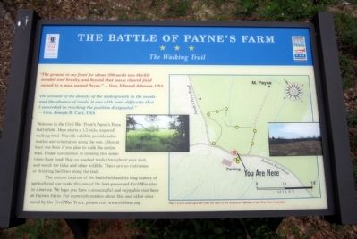
The Battle of Payne’s Farm
The Walking Trail
“On account of the density of the undergrowth in the woods and the absence of roads, it was with some difficulty that I succeeded in reaching the position designated.”—Gen. Joseph B. Carr, USA
Welcome to the Civil War Trust’s Payne’s Farm Battlefield. Here starts a 1.5 mile, unpaved walking trail. Wayside exhibits provide information and orientation along the way. Allow at least one hour if you plan to walk the entire trail. Please use caution in crossing this sometimes busy road. Stay on marked trails throughout your visit, and watch for ticks and other wildlife. There are no restrooms or drinking facilities along the trail.
The remote location of the battlefield and its long history of agricultural use make this one of the best preserved Civil War sites in America. We hope you have a meaningful and enjoyable visit here at Payne’s Farm. For more information about this and other sites saved by the Civil War Trust, please visit www.civilwar.org.
(capton)
This 1.5 mile walking trail visits the sites of the deadliest fighting of the Mine Run Campaign.
Erected 2011 by The Civil War Trust and Virginia Civil War Trails.
Topics and series. This historical marker is listed in this topic list: War, US Civil. In addition, it is included in the Virginia Civil War Trails series list.
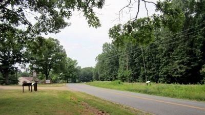
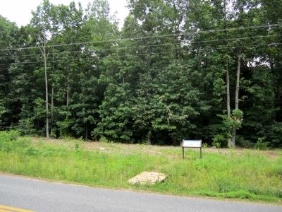
Location. 38° 19.944′ N, 77° 49.7′ W. Marker is in Locust Grove, Virginia, in Orange County. Marker is at the intersection of Zoar Road (Virginia Route 611) and Zoar School Road, on the right when traveling north on Zoar Road. Touch for map. Marker is at or near this postal address: 31334 Zoar Road, Locust Grove VA 22508, United States of America. Touch for directions.
Other nearby markers. At least 8 other markers are within walking distance of this marker. The Mine Run Campaign (a few steps from this marker); a different marker also named The Mine Run Campaign (a few steps from this marker); a different marker also named The Battle of Payne’s Farm (approx. 0.2 miles away); a different marker also named The Battle of Payne’s Farm (approx. ¼ mile away); a different marker also named The Battle of Payne’s Farm (approx. ¼ mile away); a different marker also named The Battle of Payne’s Farm (approx. 0.3 miles away); a different marker also named The Battle of Payne’s Farm (approx. 0.3 miles away); a different marker also named The Battle of Payne’s Farm (approx. 0.3 miles away). Touch for a list and map of all markers in Locust Grove.
Also see . . .
1. Mine Run (Payne's Farm). American Battlefield Trust (Submitted on June 6, 2011.)
2. The Mine Run Campaign by James K. Bryant II. Essential Civil War Curriculum, Virginia Center for Civil War Studies at Virginia Tech (Submitted on June 6, 2011.)
Credits. This page was last revised on February 23, 2022. It was originally submitted on June 6, 2011, by Bernard Fisher of Richmond, Virginia. This page has been viewed 1,510 times since then and 89 times this year. Last updated on September 10, 2021, by Bradley Owen of Morgantown, West Virginia. Photos: 1, 2, 3. submitted on June 6, 2011, by Bernard Fisher of Richmond, Virginia.


