Near Columbus in Stillwater County, Montana — The American West (Mountains)
Bozeman Trail
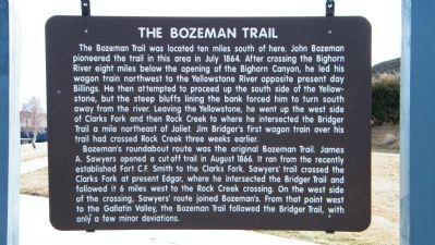
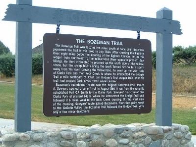
The Bozeman Trail was located ten miles south of here. John Bozeman pioneered the trail in this area in July 1864. After crossing the Bighorn River eight miles below the opening of the Bighorn Canyon, he led his wagon train northwest to the Yellowstone River opposite present day Billings. He then attempted to proceed up the south side of the Yellowstone, but the steep bluffs lining the bank forced him to turn south away from the river. Leaving the Yellowstone, he went up the west side of Clarks Fork and then Rock Creek to where he intersected the Bridger Trail a mile northeast of Joliet. Jim Bridger's first wagon train over his trail had crossed Rock Creek three weeks earlier.
Bozeman's roundabout route was the original Bozeman Trail. James A. Sawyers opened a cutoff trail in August 1866. It ran from the recently established Fort C.F. Smith to the Clarks Fork. Sawyers' trail crossed the Clarks Fork at present Edgar, where he intersected the Bridger Trail and followed it 6 miles west to the Rock Creek crossing. On the west side of the crossing, Sawyer's route joined Bozeman's. From that point west to Gallatin Valley, the Bozeman Trail followed the Bridger Trail with only a few miner deviations.
Topics. This historical marker is listed in these topic lists: Roads & Vehicles • Settlements & Settlers. A significant historical month for this entry is July 1864.
Location. 45° 36.026′ N, 109° 3.966′ W. Marker is near Columbus, Montana, in Stillwater County. Marker can be reached from Interstate 90. Marker is on Westbound Rest Area (Interstate 90 at mile marker 418), on the left of the parking area. Touch for map. Marker is in this post office area: Columbus MT 59019, United States of America. Touch for directions.
Other nearby markers. At least 8 other markers are within 8 miles of this marker, measured as the crow flies. The Great Inland Seaway (a few steps from this marker); Columbus (a few steps from this marker); The March of the Montana Column (a few steps from this marker); a different marker also named The Great Inland Seaway (approx. 0.2 miles away); Park City (approx. 0.2 miles away); a different marker also named The March of the Montana Column (approx. 0.2 miles away); Clark's Canoe Camp on the Yellowstone (approx. 7.6 miles away); United Methodist Episcopal Church (approx. 7.6 miles away). Touch for a list and map of all markers in Columbus.
Credits. This page was last revised on March 13, 2024. It was originally submitted on December 20, 2007, by Kevin W. of Stafford, Virginia. This page has been viewed 2,436 times since then and 41 times this year. Photos: 1. submitted on March 25, 2010, by Rich Pfingsten of Forest Hill, Maryland. 2, 3. submitted on December 20, 2007, by Kevin W. of Stafford, Virginia.


