Atchison in Atchison County, Kansas — The American Midwest (Upper Plains)
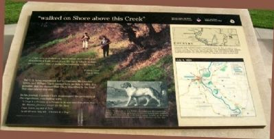
"walked on Shore above this Creek"
"…Capt. Lewis walked on Shore above this Creek and discovered a high moun from the top of which he had an extensive view, 3 paths Concentering at the moun..."
William Clark
July 4, 1804
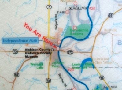
The U.S. Army expedition led by Captains Meriwether Lewis and William Clark paused here on July 4, 1804. It is possible that the mound that Clark described is the bluff that rises above this site.
In his journal, Captain Clark enumerated the members of the expedition, concluding with:
"1 Corpl & 4 Privates in a Perogue to be sent back from Plate river
Mr. Dueron [Dorion] inteptr for the Sues
Capt. Lewis my Self & York
in all 46 men July 4
4 horses & a Dog"
[Captions:]
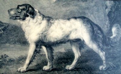
Lewis' Newfoundland dog Seaman accompanied the expedition. Seaman was a strong swimmer, exceptional hunter, and stalwart guard. His contributions made him a valued member of the party. Most expedition members came to refer to Seaman as "our dog."
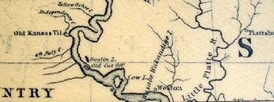
Lewis and Clark bestowed names to landmarks across the West. In what is now Atchison County, they named two local streams. One, Independence Creek, remains on maps even today. The other, 4th of July 1804 Creek, was renamed White Clay Creek after Atchison was settled in 1854. The map pictured above is from 1843.
Erected by Kansas Lewis and Clark Bicentennial Commission; National Park Service, U.S. Department of the Interior.
Topics and series. This historical marker is listed in these topic lists: Animals • Exploration • Waterways & Vessels. In addition, it is included in the Lewis & Clark Expedition series list. A significant historical month for this entry is July 1864.
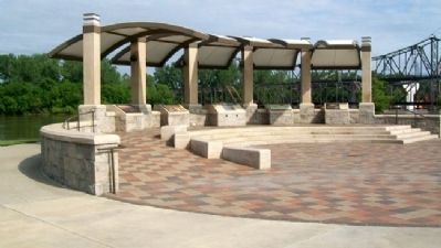
Location. 39° 33.704′ N, 95° 6.832′ W. Marker is in Atchison, Kansas, in Atchison County. Marker is at the intersection of River Road and Commercial Street, on the right when traveling north on River Road. Marker is at the Riverfront Park pavilion. Touch for map. Marker is in this post office area: Atchison KS 66002, United States of America. Touch for directions.
Other nearby markers. At least 8 other markers are within walking distance of this marker. The Lewis and Clark Expedition (here, next to this marker); Homeland of the Kanza Indians (a few steps from this marker); "the water…contains a half…Glass of ooze" (a few steps from this marker); Atchison Veterans Memorial (within shouting distance of this marker); USS Arizona Memorial (within shouting distance of this marker); Lewis Discovers a High Mound (within shouting distance of this marker); Butterfield's Overland Dispatch (within shouting distance of this marker); Under a large Cottonwood… (within shouting distance of this marker). Touch for a list and map of all markers in Atchison.
Also see . . .
1. Lewis and Clark National Historic Trail. National Park Service website entry (Submitted on July 20, 2011, by William Fischer, Jr. of Scranton, Pennsylvania.)
2. The Journals of the Lewis and Clark Expedition. Website homepage (Submitted on July 20, 2011, by William Fischer, Jr. of Scranton, Pennsylvania.)
3. Atchison Riverfront Park. Atchison Area Chamber of Commerce website entry (Submitted on July 20, 2011, by William Fischer, Jr. of Scranton, Pennsylvania.)
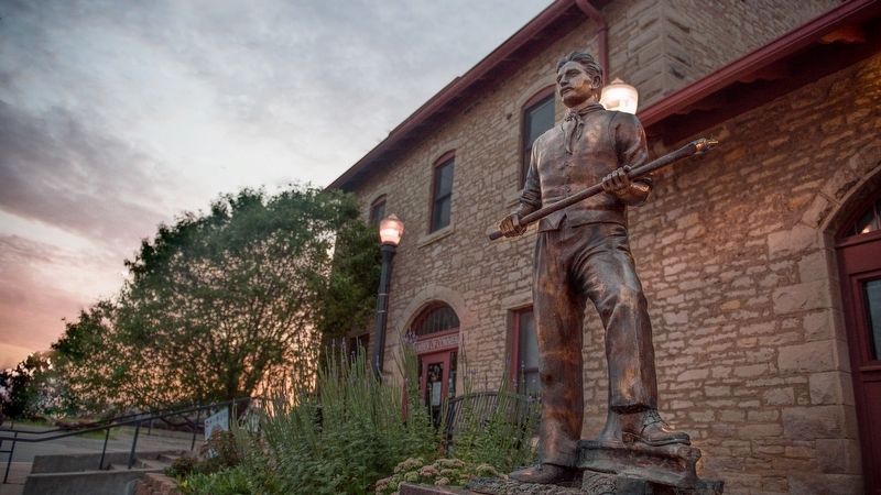
via Atchinson County Historical Society, unknown
5. Atchison County Historical Society Museum
Museum website homepage
Click for more information.
Click for more information.
Credits. This page was last revised on November 9, 2022. It was originally submitted on July 20, 2011, by William Fischer, Jr. of Scranton, Pennsylvania. This page has been viewed 761 times since then and 26 times this year. Photos: 1, 2, 3, 4. submitted on July 20, 2011, by William Fischer, Jr. of Scranton, Pennsylvania. 5. submitted on December 22, 2021, by Larry Gertner of New York, New York. 6. submitted on July 20, 2011, by William Fischer, Jr. of Scranton, Pennsylvania.
