Monongahela in Washington County, Pennsylvania — The American Northeast (Mid-Atlantic)
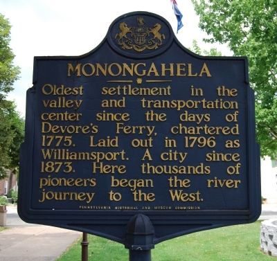
Monongahela
Oldest settlement in the valley and transportation center since the days of Devore's Ferry, chartered 1775. Laid out in 1796 as Williamsport. A city since 1873. Here thousands of pioneers began the river journey to the West.
Erected 1947 by Pennsylvania Historical and Museum Commission.
Topics and series. This historical marker is listed in these topic lists: Settlements & Settlers • Waterways & Vessels. In addition, it is included in the Pennsylvania Historical and Museum Commission series list. A significant historical year for this entry is 1775.
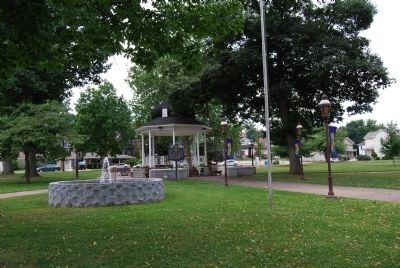
Location. 40° 12.294′ N, 79° 55.87′ W. Marker is in Monongahela, Pennsylvania, in Washington County. Marker can be reached from West Main Street (Pennsylvania Route 88/136) east of 7th Street. Located in Chess Park near the pavilion. Touch for map. Marker is in this post office area: Monongahela PA 15063, United States of America. Touch for directions.
Other nearby markers. At least 8 other markers are within walking distance of this marker. Jackie Ormes (here, next to this marker); John Pietroboni (a few steps from this marker); Veterans Memorial (a few steps from this marker); Company A, 110th Infantry Honor Roll (within shouting distance of this marker); a different marker also named Veterans Memorial (within shouting distance of this marker); Veterans Honor Roll Memorial (within shouting distance of this marker); Company A, 110th Infantry Regiment Memorial (within shouting distance of this marker); Roll of Honor (within shouting distance of this marker). Touch for a list and map of all markers in Monongahela.
Also see . . . City of Monongahela PA. Official Site (Submitted on July 25, 2011, by Mike Wintermantel of Pittsburgh, Pennsylvania.)
Credits. This page was last revised on October 17, 2023. It was originally submitted on July 25, 2011, by Mike Wintermantel of Pittsburgh, Pennsylvania. This page has been viewed 547 times since then and 10 times this year. Photos: 1, 2. submitted on July 25, 2011, by Mike Wintermantel of Pittsburgh, Pennsylvania.

