Council Grove in Morris County, Kansas — The American Midwest (Upper Plains)
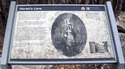
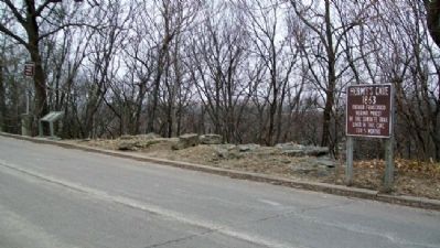
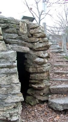
Hermit's Cave
"He appears rather an intelligent man, speaks nine different languages. He has lived a Hermit some thirty five years... Last winter he lived five months in a hollow tree near Westport, Mo. He refuses to eat bread or meat; his food consists of corn meal mixed with water or milk without cooking.
- Council Grove Press
April 27, 1863
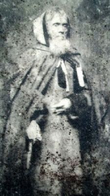
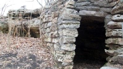
Down the steps and under the rock in front of you is a small recess. For a few months in 1863, it was home to a religious mystic. Born in 1801 in Novara, Italy, he was known locally as Father Francesco. In his travels through Europe and the Americas, he used other names, including Matteo Boccalini, and his birthname, Giovanni Maria de Agostini.
Son of a nobleman, he received a fine education in preparation for the priesthood, but reportedly was forced to leave Italy after falling in love with a young lady.
He left Council Grove with a wagon train owned by Don Eugenio Romero and captained by Dionicio Gonzalez, walking the entire 550 miles to Las Vegas, New Mexico. There, he is said to have performed miracle cures, which attracted crowds. He retreated to a nearby mountain. Initially called the Hermit of El Porvenir, he lived in a cave on what came to be known as Hermit's Peak. The citizens of Las Vegas soon built him a small cabin, where he carved religious emblems, which he traded in town for cornmeal.
The Hermit left for southern New Mexico and the Organ Mountains in 1867. He was mysteriously murdered in 1869.
Erected by National Park Service and City of Council Grove.
Topics and series. This historical marker is listed in these topic lists: Churches & Religion • Roads & Vehicles • Settlements & Settlers. In addition, it is included in the Santa Fe Trail series list. A significant historical date for this entry is April 27, 1863.
Location. 38° 39.75′ N, 96° 29.661′ W. Marker is in Council Grove, Kansas, in Morris County. Marker is on Belfry Street near Hays Street, on the right when traveling north. Touch for map. Marker is in this post office area: Council Grove KS 66846, United States of America. Touch for directions.
Other nearby markers. At least 8 other markers are within walking distance of this marker. A different marker also named Hermit's Cave (here, next to this marker); Old Bell (about 300 feet away, measured in a direct line); Last Chance Store (approx. 0.2 miles away); a different marker also named Last Chance Store (approx. 0.2 miles away); The Cottage House Hotel and Motel (approx. 0.2 miles away); First Santa Fe Pack Train (approx. 0.2 miles away); The Mormon Battalion at Council Grove, Kansas (approx. ¼ mile away); Kaw Mission (approx. ¼ mile away). Touch for a list and map of all markers in Council Grove.
Also see . . .
1. Hermit's Peak. Wikipedia entry (Submitted on August 1, 2011, by William Fischer, Jr. of Scranton, Pennsylvania.)
2. Hermit's Peak and Its Legend. Take a Road Trip website entry (Submitted on August 1, 2011, by William Fischer, Jr. of Scranton, Pennsylvania.)
3. Santa Fe National Historic Trail. National Park Service website entry (Submitted on August 1, 2011, by William Fischer, Jr. of Scranton, Pennsylvania.)
4. Council Grove. Website homepage (Submitted on March 22, 2022, by Larry Gertner of New York, New York.)
Credits. This page was last revised on March 22, 2022. It was originally submitted on July 29, 2011, by William Fischer, Jr. of Scranton, Pennsylvania. This page has been viewed 1,593 times since then and 53 times this year. Photos: 1, 2, 3, 4, 5. submitted on August 1, 2011, by William Fischer, Jr. of Scranton, Pennsylvania.
