Strong City in Chase County, Kansas — The American Midwest (Upper Plains)
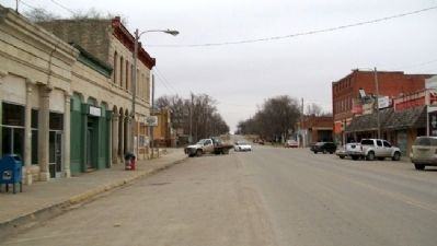
Strong City
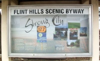
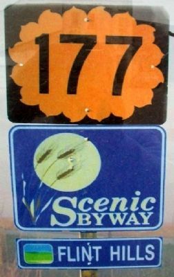
Flint Hills Scenic Byway
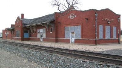
Originally named Cottonwood Station, Strong City received its current name from W.B. Strong, president of the Atchison, Topeka and Santa Fe Railroad. This was an important railroad town and was also known for its stone quarries and stone contracting firms.
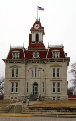
Stone from the nearby quarries was used for the Chase County courthouse as well as the State Capitol building in Topeka. Crushed stone was also used to build the railroad beds.
Prairie fires have occurred in the Flint Hills for centuries. Some are started by lightning, and - in times past - some were lit by Native Americans to control bison movement. Today ranchers use prairie fires to manage pasture plants and to improve pasture for grazing. The fires are highly visible during spring nights.
Every year the Flint Hills Rodeo is held in Strong City the first full weekend of June. Founded in 1937 by members of the E.C. Roberts family, it is the oldest consecutive professional rodeo in Kansas.
The Roberts family members were rodeo celebrities. In the 1940s Gerald Roberts was World Champion All-Around Cowboy, and Ken Roberts was a World Champion Bull Rider.
Margie Roberts Hall was a trick rider who performed at major rodeos for 25 years and was inducted into the Cowgirl Hall of Fame in Oklahoma.
Just north of Strong City on the Flint Hills Scenic Byway (K-177) is the Tallgrass Prairie National Preserve, which includes the former Z-Bar/Spring Hill Ranch built in 1873 by Stephen Jones, a cattle baron from Colorado. He built a magnificent three-story barn, a lovely Second Empire-style mansion of native limestone, and a unique outhouse.
Stop at the preserve to tour the ranch buildings, walk the 1.75-mile nature trail, tour the Lower Fox Creek Schoolhouse, and take a ranger-led tour out on the open prairie.
2000 Population: 584
Founded: 1871
Elevation: 1182'
Erected by Flint Hills Scenic Byway.
Topics and series. This historical marker is listed in these topic lists: Environment • Industry & Commerce • Railroads & Streetcars • Settlements & Settlers. In addition, it is included in the Atchison, Topeka and Santa Fe Railway series list. A significant historical year for this entry is 1937.
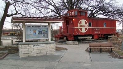
Location. 38° 23.677′ N, 96° 32.361′ W. Marker is in Strong City, Kansas, in Chase County. Marker is at the intersection of Cottonwood Street (State Highway 177) and the railroad crossing, on the right when traveling south on Cottonwood Street. Marker is in W.B. Strong Memorial Railroad Park. Touch for map. Marker is in this post office area: Strong City KS 66869, United States of America. Touch for directions.
Other nearby markers. At least 8 other markers are within 2 miles of this marker, measured as the crow flies. W.B. Strong Memorial Railroad Park (a few steps from this marker); Cottonwood River Bridges at Cottonwood Falls (approx. 1.3 miles away); Cottonwood River Dam (approx. 1.3 miles away); Bates Grove and the Area Adjacent to the Cottonwood River Dam (approx. 1.3 miles away); Chase County and the City of Cottonwood Falls (approx. 1.3 miles away); Connecting the Chase County Community (approx. 1.4 miles away); Oldest Operating Courthouse in Kansas (approx. 1.7 miles away); Chase County War Memorial (approx. 1.7 miles away).
Also see . . .
1. Flint Hills Scenic Byway. (Submitted on August 4, 2011, by William Fischer, Jr. of Scranton, Pennsylvania.)
2. Tallgrass Prairie National Preserve. (Submitted on August 4, 2011, by William Fischer, Jr. of Scranton, Pennsylvania.)
3. Strong City Santa Fe Depot National Register Nomination. (Submitted on August 4, 2011, by William Fischer, Jr. of Scranton, Pennsylvania.)
4. Chase County Courthouse National Register Nomination. (Submitted on August 4, 2011, by William Fischer, Jr. of Scranton, Pennsylvania.)
5. Spring Hill Ranch National Historic Landmark Nomination. (Submitted on August 4, 2011, by William Fischer, Jr. of Scranton, Pennsylvania.)
Credits. This page was last revised on December 7, 2021. It was originally submitted on August 4, 2011, by William Fischer, Jr. of Scranton, Pennsylvania. This page has been viewed 676 times since then and 42 times this year. Photos: 1, 2, 3, 4, 5, 6. submitted on August 4, 2011, by William Fischer, Jr. of Scranton, Pennsylvania.
