Port Aransas in Nueces County, Texas — The American South (West South Central)
World War II Coastal Defenses at the Aransas Pass
Inscription.
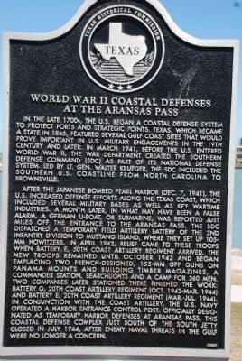
In the late 1700's the US began a coastal defense system to protect ports and strategic points. Texas, which became a State in 1845, featured several Gulf Coast sites that would prove important in the US Military engagements in the 19th Century and later. In March 1941, before the US entered World War II, the war department created the Southern Defense Command (SDC) as part of its national defense system. Led by Lt. Gen. Walter Krueger, the SDC included the Southern US coastline from North Carolina to Brownsville.
After Japanese bombed Pearl Harbor (Dec. 7, 1941), the US increased defense efforts along the Texas coast, which included several Military Bases as well as key wartime industries. A month later, in what may have been a false alarm, a German U-boat, of submarine, was reported just miles off the entrance to the Aransas Pass. The SDC dispatched a temporary field artillery battery of the 2nd Infantry Division to Mustang Island, where they set up 105 MM Howitzers. In April 1942, relief came to these troops when Battery E, 50th Coast Artillery Regiment arrived. The new troops remained until October 1942 and began emplacing two French-Designed 155-MM GPF guns on Panama Mounts and building timber magazines, a commander station, searchlights and a camp for 360 men. Two companies later stationed there finished the work: Battery G, 20th Coast Artillery Regiment (Oct. 1942-Mar.1944) and Battery E, 20th Coast Artillery Regiment (Mar.-Jul. 1944) in conjunction with the Coast Artillery, the US Navy operated a harbor entrance control post. Officially designated and temporary harbor defenses at Aransas Pass, this Coastal defense complex just South of the South Jetty closed in July 1944, after enemy Naval threats in the Gulf were no longer a concern.
Erected 2005 by Texas Historical Commission. (Marker Number 15267.)
Topics. This historical marker is listed in these topic lists: War, World II • Waterways & Vessels. A significant historical month for this entry is March 1941.
Location. 27° 50.471′ N, 97° 3.816′ W. Marker is in Port Aransas, Texas, in Nueces County. Marker is on J. C. Barr Boulevard. Touch for map. Marker is in this post office area: Port Aransas TX 78373, United States of America. Touch for directions.
Other nearby markers. At least 8 other markers are within 7 miles of this marker, measured as the crow flies. Aransas Pass (within shouting distance of this marker); Port Aransas Memorial (about 300 feet away, measured in a direct line); Tarpon Inn (approx. 0.3 miles away); Mustang Island (approx. 0.4 miles away); The Mercer Family on Mustang Island (approx. 0.4 miles away); Terminal Railroad (approx. 6.4 miles away); Aransas Pass First Baptist Church (approx. 6.6 miles away); Great Land Lottery of Aransas Pass (approx. 7 miles away). Touch for a list and map of all markers in Port Aransas.
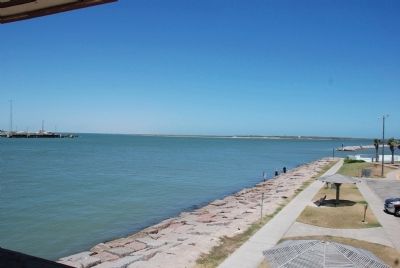
More about this marker. Located near the harbor at the Roberts Point Park.
Credits. This page was last revised on June 16, 2016. It was originally submitted on August 8, 2011, by Steve Henderson of Marble Falls, Texas. This page has been viewed 1,332 times since then and 67 times this year. Photos: 1, 2. submitted on August 8, 2011, by Steve Henderson of Marble Falls, Texas. • Kevin W. was the editor who published this page.

