Chilhowie in Smyth County, Virginia — The American South (Mid-Atlantic)
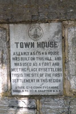
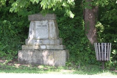
Town House
As early as 1754 a house was built on this hill, and was used as a fort and meeting place by settlers. This is the site of the first settlement in this region.
Erected by State C. and D. Comm. Sycamore No. 117-K Chapter, Daughters of the American Revolution.
Topics and series. This historical marker is listed in these topic lists: Colonial Era • Settlements & Settlers. In addition, it is included in the Daughters of the American Revolution series list. A significant historical year for this entry is 1754.
Location. 36° 47.834′ N, 81° 41.069′ W. Marker is in Chilhowie, Virginia, in Smyth County. Marker is on West Lee Highway (U.S. 11) just west of Whitetop Road (Virginia Route 107), on the right when traveling south. This marker is a couple of blocks from Interstate 81 Exit 35. Touch for map. Marker is at or near this postal address: 276 W Lee Hwy, Chilhowie VA 24319, United States of America. Touch for directions.
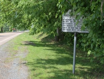
Other nearby markers. At least 8 other markers are within 3 miles of this marker, measured as the crow flies. Farthest West, 1750 (here, next to this marker); Chilhowie (a few steps from this marker); a different marker also named Chilhowie (approx. 0.2 miles away); Transportation Through the Ages (approx. 0.2 miles away); Chilhowie Methodist Episcopal Church (approx. 0.4 miles away); Sulphur Springs Church and Campground (approx. ¾ mile away); Smyth County / Washington County (approx. one mile away); William Campbell’s Grave (approx. 2½ miles away). Touch for a list and map of all markers in Chilhowie.
Also see . . . Frontier Trail. Wilderness Road website entry (Submitted on February 18, 2022, by Larry Gertner of New York, New York.)
Credits. This page was last revised on February 18, 2022. It was originally submitted on August 10, 2011, by J. J. Prats of Powell, Ohio. This page has been viewed 1,127 times since then and 68 times this year. Photos: 1, 2, 3. submitted on August 10, 2011, by J. J. Prats of Powell, Ohio.
Editor’s want-list for this marker. Photos of the ruins of Town House off Route 107. • Can you help?


