Perryville in Boyle County, Kentucky — The American South (East South Central)
Stewart's Advance
Perryville • The Battle For Kentucky
— October 8, 1862 —
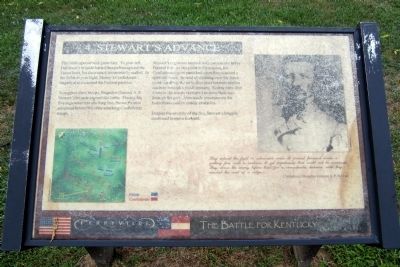
To support these troops, Brigadier General A. P. Stewart's brigade entered the battle. Placing his five regiments into one long line, Stewart's men advanced behind the other attacking Confederate troops.
Stewart's regiments immediately came under heavy Federal fire. At one point in the combat, his Confederates grew panicked when they reached a split-rail fence. Instead of climbing over the fence or taking down the rails, dozens of his men tried to squeeze through a small opening. Scores were shot down as the troops attempted to force their way through the gate. Man-made structures on the battlefield could be deadly obstacles.
Despite the severity of the fire, Stewart's brigade continued to move forward.
They entered the fight in admirable order & pressed forward under a galling fire, with a coolness & yet impetuosity that could not be surpassed. They drove the enemy before them for a considerable distance until they reached the crest of the ridge.
Confederate Brigadier General A. P. Stewart
Topics. This historical marker is listed in this topic list: War, US Civil.
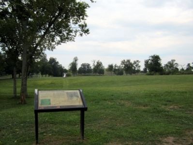
Location. 37° 40.615′ N, 84° 58.116′ W. Marker is in Perryville, Kentucky, in Boyle County. Marker can be reached from the intersection of Park Road and Battlefield Road (Kentucky Route 1920). Located in Perryville Battlefield State Historic Site. Touch for map. Marker is at or near this postal address: 1825 Battlefield Road, Perryville KY 40468, United States of America. Touch for directions.
Other nearby markers. At least 8 other markers are within walking distance of this marker. Army of the Mississippi (about 400 feet away, measured in a direct line); Maney's Attack (about 700 feet away); Turner's Battery (about 700 feet away); The Opening Attack (about 800 feet away); Sgt. Harris B. Cope Memorial (about 800 feet away); Assault on Parsons’ Ridge (approx. 0.2 miles away); Army of the Ohio (approx. 0.2 miles away); Union Monument (approx. 0.2 miles away). Touch for a list and map of all markers in Perryville.
More about this marker. On the upper right is a photograph of Confederate Brigadier General A. P. Stewart. From Generals in Gray
Credits. This page was last revised on November 3, 2021. It was originally submitted on August 23, 2011, by Bernard Fisher of Richmond, Virginia. This page has been viewed 841 times since then and 18 times this year. Photos: 1, 2. submitted on August 23, 2011, by Bernard Fisher of Richmond, Virginia. 3. submitted on September 14, 2015, by Brandon Fletcher of Chattanooga, Tennessee.


