Lovelock in Pershing County, Nevada — The American Mountains (Southwest)
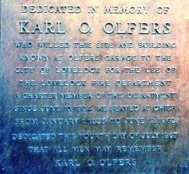
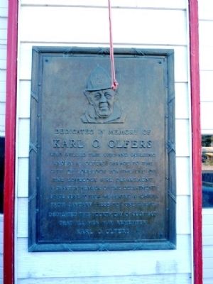
Dedicated to the Memory of Karl O. Olfers
Inscription.
Kark O. Olfers
Erected 1967.
Topics. This historical marker is listed in these topic lists: Charity & Public Work • Roads & Vehicles. A significant historical month for this entry is January 1795.
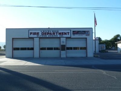
Location. 40° 10.883′ N, 118° 28.409′ W. Marker is in Lovelock, Nevada, in Pershing County. Marker is on Cornell Avenue (Business Route 80 at milepost 106), just south of 12th Street, on the right when traveling north. Starting at MP 106 offramp going toward Main Street - go 0.2 mi. Turn Left on Main Street NV-398) - go 0.20 mi. Turn Right on Cornell Avenue (NV-396) - go 0.10 mi. Fire Station is near 12th Street and Cornell, east side of street. Touch for map. Marker is in this post office area: Lovelock NV 89419, United States of America. Touch for directions.
Other nearby markers. At least 8 other markers are within walking distance of this marker. The Ice House (within shouting distance of this marker); Pershing County Court House (approx. 0.2 miles away); Pershing County (approx. 0.2 miles away); Applegate-Lassen Emigrant Trail (approx. 0.9 miles away); Seven Troughs Mining District (approx. 0.9 miles away); The Marzen House (approx. 0.9 miles away); Mazuma (approx. 0.9 miles away); La' Belle Brothel 1961-1981 (approx. 0.9 miles away). Touch for a list and map of all markers in Lovelock.
Credits. This page was last revised on December 22, 2020. It was originally submitted on August 25, 2011, by Chris English of Phoenix, Arizona. This page has been viewed 539 times since then and 11 times this year. Photos: 1, 2, 3. submitted on August 25, 2011, by Chris English of Phoenix, Arizona. • Syd Whittle was the editor who published this page.


