Pleasant Grove East in Chesapeake, Virginia — The American South (Mid-Atlantic)
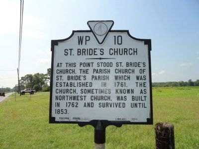
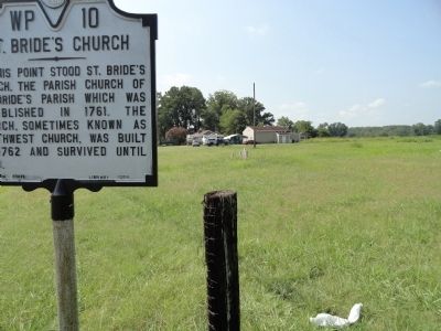
St. Bride's Church
Erected 1964 by Virginia State Library. (Marker Number WP-10.)
Topics and series. This historical marker is listed in these topic lists: Churches & Religion • Colonial Era. In addition, it is included in the Virginia Department of Historic Resources (DHR) series list. A significant historical year for this entry is 1761.
Location. 36° 36.142′ N, 76° 12.655′ W. Marker is in Chesapeake, Virginia. It is in Pleasant Grove East. Marker is at the intersection of Battlefield Blvd S and St. Brides Road West, on the right when traveling south on Battlefield Blvd S. To visit this marker, you must be on Battlefield Blvd and not the expressway. If you start out on the express way, take the Edinburgh Exit and travel the rest of the way south on Battlefield. Touch for map. Marker is in this post office area: Chesapeake VA 23322, United States of America. Touch for directions.
Other nearby markers. At least 8 other markers are within 8 miles of this marker, measured as the crow flies. Pleasant Grove Baptist Church Cemetery (approx. 2.6 miles away); Seven Patriot Heroes (approx. 3 miles away); The Cuffeytown Thirteen (approx. 3.2 miles away); Dividing Line (approx. 3.7 miles away in North Carolina); Moyock (approx. 5.8 miles away in North Carolina); Great Bridge Schoolhouse Monument (approx. 7.8 miles away); Southern Branch Chapel / Battle of Great Bridge / Wilson Family (approx. 8 miles away); Norfolk County Almshouse (approx. 8.1 miles away). Touch for a list and map of all markers in Chesapeake.
Credits. This page was last revised on February 1, 2023. It was originally submitted on August 26, 2011, by Chris Bieber of Chesapeake, Virginia. This page has been viewed 1,409 times since then and 69 times this year. Photos: 1, 2. submitted on August 26, 2011, by Chris Bieber of Chesapeake, Virginia. • Bill Pfingsten was the editor who published this page.

