Searsport in Waldo County, Maine — The American Northeast (New England)
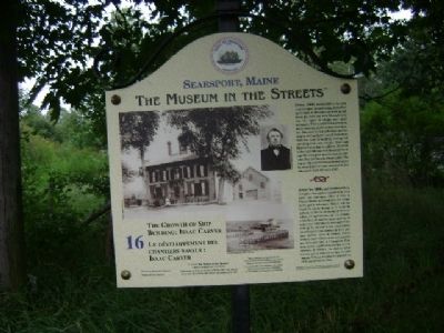
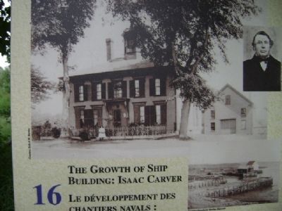
The Growth of Ship Building: Isaac Carver / Le développement des chantiers navals : Isaac Carver
Searsport, Maine
— The Museum in the Streets —
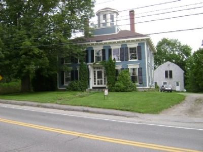
Until 1800, Settlers in the area were occupied in establishing themselves on the land. At the same time trade up and down the coast and with Massachusetts was by water in sloops and small schooners. These coastal farmers were as much coastwise sailors as they were farmers. The trade in fish and wood and the surplus of their farms would soon show them the value of building, owning and operating their own vessels. Isaac and Hannah Carver had 11 children. All seven of the male children, with the exception of one who died, grew up to become sea captains. One also became a boat builder. The Carver shipyard which was located across the street from this house produced its first schooner in 1824, the last in 1882.
Erected 2009 by The Museum in the Streets®. (Marker Number 16.)
Topics and series. This historical marker is listed in these topic lists: Industry & Commerce • Waterways & Vessels. In addition, it is included in the The Museum in the Streets®: Searsport, Maine series list. A significant historical year for this entry is 1800.
Location. 44° 27.532′ N, 68° 55.329′ W. Marker is in Searsport, Maine, in Waldo County. Marker is at the intersection of East Main Street (Rt. US-1) and Mortland Road, on the left when traveling east on East Main Street (Rt. US-1). Touch for map. Marker is in this post office area: Searsport ME 04974, United States of America. Touch for directions.
Other nearby markers. At least 8 other markers are within walking distance of this marker. First Day at Central School: Circa 1900 / Premier jour d'école : Central school ca. 1900 (about 500 feet away, measured in a direct line); Carver Memorial Library / La Bibliothèque Carver (about 500 feet away); Civil War Soldiers' Monument / Monumnet aux soldats et La Guerre de Sécession (about 600 feet away); Liberty Tree Memorial (about 600 feet away); Union Hall (about 700 feet away); Main Street, 1875 (about 700 feet away); Making a Living / Gagner sa vie (about 800 feet away); Peter Ward, Ship Carpenter: Living and Working in a Neighborhood of Artisans (approx. 0.2 miles away). Touch for a list and map of all markers in Searsport.
More about this marker. Marker #16 (of 17) in "The Museum in the Streets". The text on the Marker is in English, followed by a French translation.
Credits. This page was last revised on December 3, 2021. It was originally submitted on August 30, 2011, by James True of Newark, New Jersey. This page has been viewed 670 times since then and 19 times this year. Photos: 1, 2, 3. submitted on August 30, 2011, by James True of Newark, New Jersey. • Bill Pfingsten was the editor who published this page.
Editor’s want-list for this marker. Transcription of the French text • Can you help?


