St. Joseph in Buchanan County, Missouri — The American Midwest (Upper Plains)
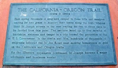
The California - Oregon Trail
1840s & 1850s
Each spring thousands of emigrants camped in these hills and meadows waiting for new grass to support their teams along the trail. Wagons lined St. Joseph streets to the east waiting for two to three days to be ferried from this point. The settlers faced up to five months of hardships, sickness and danger in a trip beyond the protection of the U.S. Government. In the 1840s and 50s, hundreds of thousands of emigrants followed the St. Joe Road west seeking homesteads or gold on the California and Oregon trails.
As the Western expansion continued, St. Joseph became a major wholesale and business center.
Topics and series. This historical marker is listed in these topic lists: Exploration • Industry & Commerce • Roads & Vehicles • Settlements & Settlers. In addition, it is included in the California Trail, and the Oregon Trail series lists.
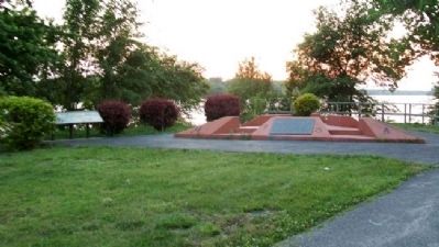
Location. 39° 45.978′ N, 94° 51.65′ W. Marker is in St. Joseph, Missouri, in Buchanan County. Marker is in the Missouri riverfront park, accessed via Francis Street, and about 200 yards southwest of the I-229 Exit 6A ramps. Touch for map. Marker is in this post office area: Saint Joseph MO 64501, United States of America. Touch for directions.
Other nearby markers. At least 8 other markers are within walking distance of this marker. Pony Express (here, next to this marker); Joseph Robidoux (here, next to this marker); St. Michael's Prairie / The Lewis and Clark Expedition (here, next to this marker); a different marker also named Pony Express (approx. 0.2 miles away); The Journey West (approx. ¼ mile away); Missouri Valley Trust Company (approx. 0.3 miles away); The Boder Building (approx. 0.3 miles away); Buchanan County Courthouse (approx. 0.4 miles away). Touch for a list and map of all markers in St. Joseph.
Also see . . .
1. California National Historic Trail. (Submitted on September 22, 2011, by William Fischer, Jr. of Scranton, Pennsylvania.)
2. Oregon National Historic Trail. (Submitted on September 22, 2011, by William Fischer, Jr. of Scranton, Pennsylvania.)
3. Oregon-California Trails Association. (Submitted on September 22, 2011, by William Fischer, Jr. of Scranton, Pennsylvania.)
Credits. This page was last revised on June 16, 2016. It was originally submitted on September 22, 2011, by William Fischer, Jr. of Scranton, Pennsylvania. This page has been viewed 771 times since then and 21 times this year. Photos: 1, 2. submitted on September 22, 2011, by William Fischer, Jr. of Scranton, Pennsylvania.

