Leon in Madison County, Virginia — The American South (Mid-Atlantic)
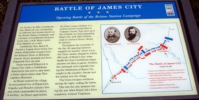
Battle of James City
Opening Battle of the Bristoe Station Campaign
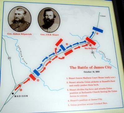
Confederate Gen. James B. Gordon’s brigade drove Union Gen. Judson Kilpatrick’s troopers from the Robinson River to Bethsaida Church. Stuart attacked and drove Kilpatrick from the field.
Stuart pursued Kilpatrick to James City while a Confederate detachment was sent to shut down a Union signal station atop Thoroughfare Mountain.
As Stuart entered the village, he encountered two of Kilpatrick’s brigades and French’s infantry division which commanded six pieces of artillery. As Stuart approached, the Union troops withdrew to a position across Crooked Run in Culpeper County. They drew up in line of battle on a hill overlooking James City, with their artillery ready to confront Stuart, should he advance.
Throughout the remainder of the day, the opposing batteries engaged one another. About 4 p.m. the Union cavalry charged to within 200 yards of Stuart’s line, when deadly fire from Confederate sharpshooters cut them to pieces. Artillery fire continued until nightfall, leaving the inhabitants of James City caught in the crossfire. Smoke and fire settled over the village.
The Union troopers withdrew during the night, ending the battle.
This was the only instance during the war when Stuart led a force completely without Virginians.
Erected by Virginia Civil War Trails.
Topics and series. This historical marker is listed in this topic list: War, US Civil. In addition, it is included in the Virginia Civil War Trails series list. A significant historical month for this entry is October 1818.
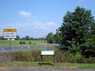
Location. 38° 26.26′ N, 78° 8.276′ W. Marker is in Leon, Virginia, in Madison County. Marker can be reached from Leon Road (Virginia Route 631). Marker is on Leon Road (VA Rt. 631) just south of Route 29. Touch for map. Marker is in this post office area: Leon VA 22725, United States of America. Touch for directions.
Other nearby markers. At least 8 other markers are within 5 miles of this marker, measured as the crow flies. Kirtley's Road (approx. 0.2 miles away); Engagement at James City (approx. 0.3 miles away); Madison County / Culpeper County (approx. half a mile away); Third Wis. Infty. (approx. 4.3 miles away); Battle of Cedar Mountain (approx. 4.3 miles away); a different marker also named Battle of Cedar Mountain (approx. 4.4 miles away); a different marker also named Battle of Cedar Mountain (approx. 4.4 miles away); Hand-to-Hand Fighting (approx. 4.4 miles away). Touch for a list and map of all markers in Leon.
More about this marker. The marker features photos of Gens. Judson Kilpatrick and J.E.B. Stuart. Included also is a map outlining the movements and sequence of events of the Battle of James City.
Also see . . .
1. Battle of James City. excerpts from the Madison Eagle May 13, 1999. (Submitted on January 16, 2008, by Craig Swain of Leesburg, Virginia.)
2. History of James City. “This is the historic property otherwise known as James City in what is now Leon, Virginia. Daniel James first purchased the property in 1796...” (Submitted on February 14, 2008, by Andrea Lynn Bruce-Smith of Westminster, Maryland.)
Credits. This page was last revised on June 16, 2016. It was originally submitted on January 16, 2008. This page has been viewed 5,226 times since then and 130 times this year. Photos: 1, 2, 3. submitted on January 16, 2008. • Craig Swain was the editor who published this page.


