Downtown Seattle in King County, Washington — The American West (Northwest)
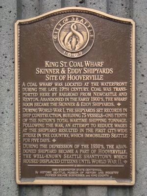
Kings St. Coal Wharf - Skinner & Eddy Shipyards - Site of Hooverville
Inscription.
A coal wharf was located at the waterfront during the late 19th century. Coal was transported here by railroad from Newcastle and Renton. Abandoned in the early 1900ís, the wharf soon became the Skinner & Eddy Shipyard.
During World War I, the shipyard set records in ship construction, building 75 vessels – one-tenth of the nationís total wartime shipping tonnage. Following the war, an attempt to reduce wages at the shipyard resulted in the first city-wide strike in the country, which immobilized Seattle for five days.
During the depression of the 1930ís, the abandoned shipyard became a part of Hooverville, the well-known Seattle shantytown which housed displaced citizens until World War II.
Erected 1989 by Historic Seattle Museum of History and Industry, Pioneer Square Businesses, and King County.
Topics. This historical marker is listed in these topic lists: Industry & Commerce • Waterways & Vessels.
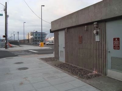
Location. 47° 35.908′ N, 122° 20.175′ W. Marker is in Seattle, Washington, in King County. It is in Downtown Seattle. Marker is at the intersection of Alaskan Way South and South King Street, on the right when traveling south on Alaskan Way South. Touch for map. Marker is at or near this postal address: 401 Alaskan Way South, Seattle WA 98104, United States of America. Touch for directions.
Other nearby markers. At least 8 other markers are within walking distance of this marker. Smith and Squire Buildings (about 600 feet away, measured in a direct line); Triangle Hotel and Bar (about 800 feet away); Earl Layman Street Clock (about 800 feet away); Ballast Island (about 800 feet away); Grand Central Hotel (approx. 0.2 miles away); How Did Water Become Land? (approx. 0.2 miles away); Steamer Idaho Wreckage (approx. 0.2 miles away); Pioneer Square Historic District (approx. 0.2 miles away). Touch for a list and map of all markers in Seattle.
Credits. This page was last revised on February 7, 2023. It was originally submitted on October 10, 2011, by Barry Swackhamer of Brentwood, California. This page has been viewed 769 times since then and 23 times this year. Photos: 1, 2. submitted on October 10, 2011, by Barry Swackhamer of Brentwood, California. • Syd Whittle was the editor who published this page.

