Newport in Newport County, Rhode Island — The American Northeast (New England)
Newport Harbor
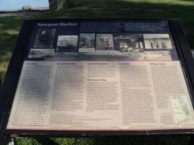
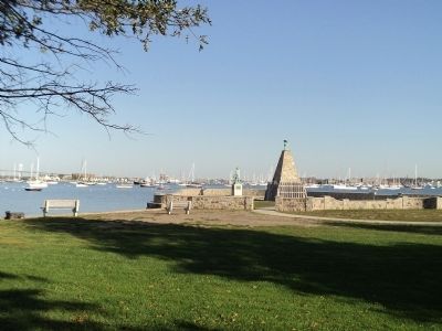
Newport Harbor has been a center of commerce and industry since the days Narragansetts and Wampanoags, Native Americans, fished the waters of this bay. The first European explorer was Giovanni da Verrazzano, an Italian who sailed for the King of France from 1524-1538 and anchored in Newport Harbor for 15 days. In colonial times, Newport was one of the five major ports and the harbor saw activity in the triangle trade of rum-slaves-molasses, as well as fishing, whaling, and shipbuilding. Today, the rich traditions of shipbuilding, fishing, and lobstering continue, side by side with a bustling scene of tourism and commercial and pleasure boating.
Fort Adams
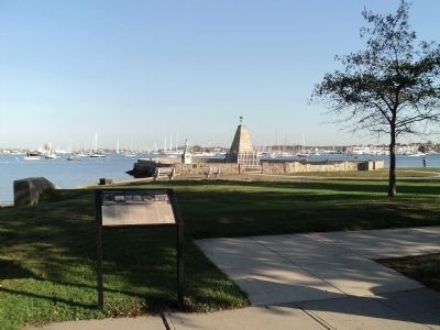
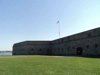
The site on which stands Fort Adams, usually visible on the horizon to your left, has been of strategic importance in defending Newport Harbor since colonial days. From 1776 through 1779 it served as the campsite for British troops occupying the city of Newport and the staging area for the British advance in the Battle of Rhode Island in 1778. The first American fort on the site was completed in 1799 and named in honor of President John Adams. Designed by French military engineer Simon Bernard and American military architect Joseph Totten, construction on the present fort began in the 1800s. It was built by stonemason Alexander MacGregor and crews of Irish and Scottish immigrants using granite shipped from Maine. Covering approximately 21 acres, its extensive landward defenses include listening tunnels and powder magazines. It is the only fort outside Europe to feature tenaille, a French land defense system used to protect the main fort against cannon fire. During wartime, Fort Adams had the capacity to garrison 2,400 soldiers, but although it housed troops until 1950, the fort never saw battle. Navy housing still occupies an area on the western side of the original fort. Today, Fort Adams stands inside a state park of 136 acres which is also home to the Newport Jazz and folk Festivals, the Museum of Yachting, sailing activities, and the Eisenhower House. Originally the home for the commandant of Fort Adams, Eisenhower House is now named for President Dwight D. Eisenhower, who visited there in the summers 1957-1960. The fort is open for tours, and the Fort Adams Trust stages military reenactments. The park is open from sunrise to sunset.
Ida Lewis Yacht Club
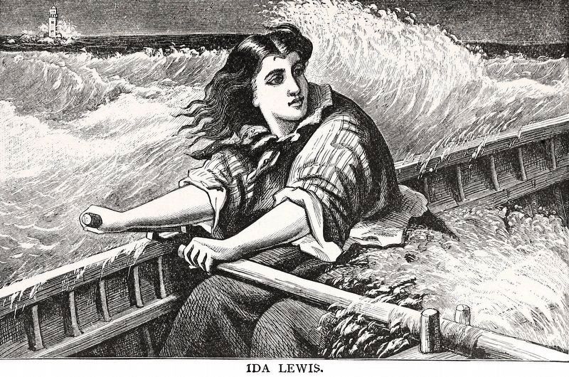
Beyond the public beach and the stone pier stands the Ida Lewis Yacht Club. Ida Lewis, born on February 25, 1842, was the daughter of the Lime Rock lightkeeper and took over his duties when he suffered a stroke. Congress appointed Ida Lewis the official lighthouse keeper in 1879, one of the first women keepers in the United States. She became nationally famous for her skill and courage in saving the lives of at least 18 accident victims from the waters of Newport Harbor and received the Congressional Lifesaving Award. Ida Lewis died in 1911. The Ida Lewis Yacht Club (ILYC) started at the Lime Rock Lighthouse in 1928. The light was subsequently automated and the lighthouse was connected to the shore by a pier. The ILYC burgee consists of a red background with a blue symbolic lighthouse and eighteen white stars representing the lives saved by Newport’s heroine. The yacht club has been the center of many international yachting events including the America’s Cup defense until 1983 and the Newport-to-Bermuda races.
Just beyond the Ida Lewis Yacht Club, the road curves sharply to the left at the former John Nicholas Brown estate. The estate is now owned by the New York Yacht Club, and their flag is just barely visible from this vantage point.
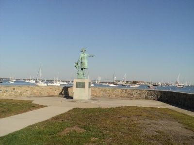
Count de Rochambeau
In the summer of 1780, after the British withdrawal, a large French force of five regiments and support troops, led by General Rochambeau, landed in Newport. General George Washington met with Rochambeau in Newport to discuss the strategy to end the war. Subsequent events involving General Rochambeau are outlined on the plaque at the base of the statue.
The Newport Bridge
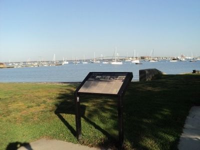
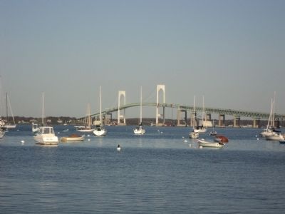
Connecting Newport and Jamestown, the bridge was completed in 1969 and relieved Newport’s dependence on car and passenger ferries. The opening of the bridge also changed the character of Newport from a quiet island community to a major destination city for international travelers and day-trippers. Visitors from New York, Connecticut, and points west no longer needed to plan their trips around making the Jamestown to Newport ferry. Always a popular summer vacation spot, Newport saw its tourism industry grow rapidly. Traffic congestion and overdevelopment continue to be a major concern.
The bridge was renamed the Pell Bridge in 1992 to honor Senator Claiborne Pell. Sunset views of this beautiful bridge delight visitors and photographers alike.
Wellington Square
The area to the far right is the former site of the Newport Gas Light Company, which operated a coal gasification utility plant from 1905 until the 1950s when the plant was abandoned. Coal was shipped to Coddington Wharf, unloaded, and moved to the gas plant. The southern end of Thames Street in the then Fifth Ward was home to many Irish workers who lived in the row houses built by the gas company. Generations of Newporters remember the smell and soot which permeated the area. A timeshare resort, hotel, and shops now occupy the site. Coddington Wharf, to the north, contains a lovely pocket park maintained by the Friends of the Waterfront and the Friends of Coddington Wharf. The park is part of the Newport Harbor Walk, which continues along rights of way to join King Park and the shoreline.
Visitors are welcome to enjoy the walk from the stone pier to Coddington Wharf and to join the countless generations who have explored and experienced the fascination of this historic harbor.
Erected by Friends of the Waterfront.
Topics and series. This historical marker is listed in these topic lists: War, US Revolutionary • Waterways & Vessels. In addition, it is included in the Former U.S. Presidents: #02 John Adams, and the Former U.S. Presidents: #34 Dwight D. Eisenhower series lists. A significant historical date for this entry is February 25, 1842.
Location. 41° 28.572′ N, 71° 19.303′ W. Marker is in Newport, Rhode Island, in Newport County. Marker is at the intersection of Wellington Avenue and Columbus Avenue, on the right when traveling west on Wellington Avenue. Marker is located in Kings Park. Touch for map. Marker is in this post office area: Newport RI 02840, United States of America. Touch for directions.
Other nearby markers. At least 8 other markers are within walking distance of this marker. Memorial to the French Fleet (within shouting distance of this marker); Rochambeau (within shouting distance of this marker); J. Joseph M. Martin (approx. half a mile away); The Francis Malbone House (approx. 0.6 miles away); Perry Mill (approx. 0.6 miles away); Peter Lee House (approx. 0.7 miles away); The Elms & Its Neighbors: The Battle for Historic Preservation (approx. 0.7 miles away); The Isaac Bell House & Its Neighbors: Progressive Architecture (approx. 0.7 miles away). Touch for a list and map of all markers in Newport.
More about this marker. Many photographs of people and events relating to Newport Harbor appear along the top of the marker. A map of the area can be found at the marker’s lower right.
Credits. This page was last revised on January 12, 2022. It was originally submitted on October 13, 2011, by Bill Coughlin of Woodland Park, New Jersey. This page has been viewed 995 times since then and 34 times this year. Last updated on January 6, 2022, by Carl Gordon Moore Jr. of North East, Maryland. Photos: 1, 2, 3, 4, 5, 6, 7. submitted on October 13, 2011, by Bill Coughlin of Woodland Park, New Jersey. 8. submitted on November 22, 2020, by Allen C. Browne of Silver Spring, Maryland. • Michael Herrick was the editor who published this page.
