James Bay in Victoria in Capital, British Columbia — Canada’s West Coast (North America)
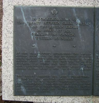
In Commemoration of the Treaty Between Great Britain and the Russian Empire
28 February 1825
— Demarcating Canada's Western Boundary —
Inscription.
[English]
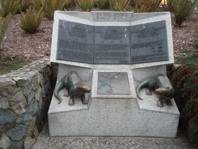
In Commemoration of the Treaty Between Great Britain and the Russian Empire, 28 February 1825, Demarcating Canada’s Western Boundary
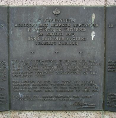
[Ukranian]
у Відзначення Договору між Великою Британією й російською імперією, 28 лютого 1825, який ВизначиВ західниі границі канади
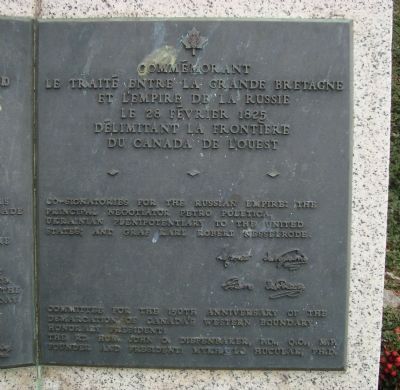
[French]
Commémorant Traité Entre la Grande Bretagne et l’Empire de la Russie, le 28 Février 1825, Delimitant la Frontiere du Canada de l’Ouest
[English]
By this treaty – which established the Anglo-Russian boundaries on the northwest coast of North America – the Russian Empire ceded to Great Britain what is now the Province of British Columbia, the Yukon and part of the North-West Territories, Great Britain ceded to the Russian Empire what is now the State of Alaska.
This treaty resolved the long international contention for maritime and territorial supremacy in the Pacific Northwest rising from independent discoveries and explorations by Russian and Ukrainians, Spaniards, British and Americans, and the overland fur-traders from Eastern Canada.
The Sea Otter – whose highly-prized furs were the mainstay of the maritime fur trade in the in the North Pacific – was a significant factor in the mercantile disputes and subsequent boundary demarcation on the Northwest Coast.
The signing of the 1825 boundary treaty extended Canada’s territorial limits from the Atlantic Ocean to the Pacific and the Arctic – as they have remained to this day
Signatory for Great Britain: The Right Honourable Stratford Canning.
Co-signatories for the Russian Empire: The principle negotiator Petro Poletica, Ukrainian plenipotentiary to the United States; and Graf Karl Robert Nesselirode
Committee for the 150th anniversary of the demarcation of Canada’s western boundary.
Honorary President:
The Rt. Hon. John C. Diefenbaker, P.C., Q.C., M.P.
Founder and President: Mykhaylo Huculak, Ph.D
Erected 1975.
Topics. This historical marker is listed in this topic list: Peace. A significant historical date for this entry is February 28, 1825.
Location.
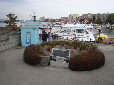
48° 25.257′ N, 123° 22.253′ W. Marker is in Victoria, British Columbia, in Capital. It is in James Bay. Marker is on Belleville Street. This marker is located in front of the Underseas Gardens aquarium. Touch for map. Marker is at or near this postal address: 500 Belleville Street, Victoria BC V8V 1W9, Canada. Touch for directions.
Other nearby markers. At least 8 other markers are within walking distance of this marker. Knowledge Totem (within shouting distance of this marker); Canadian Pacific Marine Terminal Building (within shouting distance of this marker); The Mackenzie Papineau Battalion of the International Brigades (within shouting distance of this marker); Creation of the Province of British Columbia (within shouting distance of this marker); Kwakiutl Bear Pole (about 120 meters away, measured in a direct line); Tsukuba (about 120 meters away); Fort Victoria (about 120 meters away); To Our Glorious Dead (about 120 meters away). Touch for a list and map of all markers in Victoria.
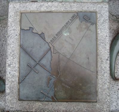
More about this marker. This marker has three panels. The title of the marker appears at the top of each panel in English (left), Ukranian (center) and French (right). The text of the marker, in English, is spread across all three panels. There is a map of the boundary line between the two outer figures.
Additional keywords. international
boundaries
Credits. This page was last revised on February 16, 2023. It was originally submitted on October 29, 2011, by Barry Swackhamer of Brentwood, California. This page has been viewed 1,206 times since then and 45 times this year. Photos: 1, 2, 3, 4, 5, 6. submitted on October 29, 2011, by Barry Swackhamer of Brentwood, California. • Bill Pfingsten was the editor who published this page.
